
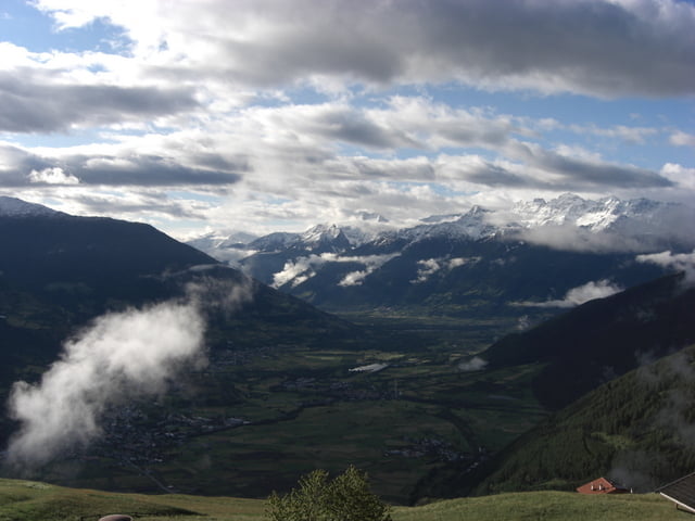

eine wunderschöne Tour beginnend auf dem Watles und führend auf die Stilfseralm. Diese Tour beinhaltet alles was das Herz begehrt, Singletrails, flowige Abfahrten, steile Anstiege, wunderschöne Landschaften.
Beginnt wie beschrieben auf dem Watles über Burgeis, Glurns, Stilfseralm, Prad, Glurns, Burgeis, Watles.
Man kann sich etwa 700Hm ersparen wenn man in Burgeis startet.
Галерея маршрутов


Карта маршрута и высотный профиль
Minimum height 895 m
Maximum height 2182 m
More about the tour author
|
|
lapierre |
Комментарии

GPS-Tracks
Trackpoints-
GPX / Garmin Map Source (gpx) download
-
TCX / Garmin Training Center® (tcx) download
-
CRS / Garmin Training Center® (crs) download
-
Google Earth (kml) download
-
G7ToWin (g7t) download
-
TTQV (trk) download
-
Overlay (ovl) download
-
Fugawi (txt) download
-
Kompass (DAV) Track (tk) download
-
Формуляр маршрута (pdf) download
-
Original file of the author (gpx) download
More about the tour author
|
|
lapierre |
Add to my favorites
Remove from my favorites
Edit tags
Open track
My score
Rate