


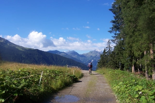
1. Etappe: Oberstdorf - Freiburger Hütte
Strecke: Oberstdorf (820 Meter) – Rappenalptal – Schrofenpass (1.687 Meter) – Lech – Formarintal – Freiburger Hütte
Übernachtung:
www.dav-freiburg.de/freiburger_huette.html
2. Etappe: Freiburger Hütte - Klosters
Strecke: Freiburger Hütte – Raues Joch – Dalaas – Kristbergsattel – Gargellen – Valxifental - Schlappiner Joch (2.202 Meter) – Klosters
Übernachtung:
3. Etappe: Klosters - Livigno
Strecke: Klosters - Davos – Dürrboden – Scalettapass ( 2.606 Meter)– Val Susauna – Val Chachauna – Chachaunapass (2.694 Meter) – Val –Federia – Livigno
Übernachtung:
4. Etappe: Livigno - Ponte di Legno
Strecke: Livignio – Alpisellapass (2.260 Meter) – Lago di Cancano – Torri di Fraele – Bormio – Gaviapass (2.661 Meter) – Ponte di Legno
Übernachtung:
www.albergofrigidolfo.it/ (in Precasaglio - kurz vor Ponte di Legno)
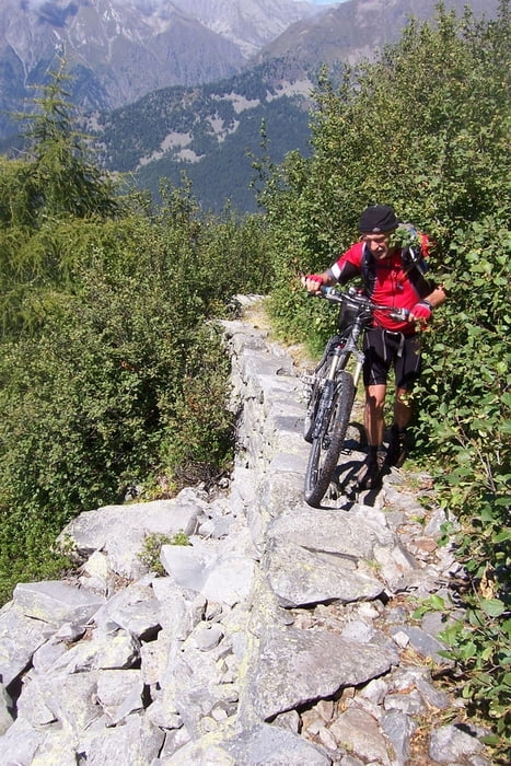
5. Etappe: Ponte di Legno - Val di Daone - (Die "Wer sein Fahrrad liebt, der schiebt + trägt" Etappe)
Strecke: Ponte di Legno – Edolo – Cedegolo – Valle – Passo di Campo (2.288 Meter) – Lago di Malga Bissina - Val di Daone
Übernachtung: Ristorante da Pierino (kurz nach Malga Bissina - einfache Zimmer - günstig)
6. Etappe: Val di Daone - Riva
Strecke: Val di Daone - Condino – Storo – Tremalzopass (1.974 Meter) – Pregasina – Riva (66 Meter)
Галерея маршрутов

Карта маршрута и высотный профиль
Minimum height 62 m
Maximum height 2682 m
More about the tour author
|
|
Staudenbiker |
Комментарии
GPS-Tracks
Trackpoints-
GPX / Garmin Map Source (gpx) download
-
TCX / Garmin Training Center® (tcx) download
-
CRS / Garmin Training Center® (crs) download
-
Google Earth (kml) download
-
G7ToWin (g7t) download
-
TTQV (trk) download
-
Overlay (ovl) download
-
Fugawi (txt) download
-
Kompass (DAV) Track (tk) download
-
Формуляр маршрута (pdf) download
-
Original file of the author (gpx) download
More about the tour author
|
|
Staudenbiker |
Add to my favorites
Remove from my favorites
Edit tags
Open track
My score
Rate
Wollt mal fragen wie stark die Straße (SS300) von Bormio nach Ponte di Legno befahren war. Gehts oder muss man da um sein Leben fürchten? Das Stück ab Bormio bis nach Riva soll vielleicht ein Teil meiner Tour 2010 werden. Gruß
Die Trackdaten sind super!
5 Tage?