Login

Забыл пароль?

Cookies have to be accepted!
Your browser's cookie functionality is disabled. Please enable this functionality.

Not a member yet?

Register now
Login

Available for registred users only

Log in to use this feature.

Забыл пароль?

Cookies have to be accepted!
Your browser's cookie functionality is disabled. Please enable this functionality.

Not a member yet?

Register now
Filter
Категории
Advanced filters
  • Длина (км)
  • Высотомер
Сохранить фильтр Reset filter

TrackRank

QRCode

Technical data

Длина8,8 km Высотомер222 m Way down223 m Длительность04:00 h:m Дата12.07.2009
Оценки Author Ландшафт Веселье Кондиция Техника

Статистика

794 Виды Оценки 197 Загрузки Среднее
Rate
  • Формуляр маршрута
  • Дорога
  • Загрузки

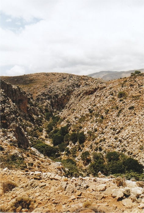
This is a hiking-track in the area of Kato Zakros (Eastern End of Crete).

It is a nice round-trip offering panoramic views into the famous Gorge of Dead. The northern part of the track should be followed first, because it runs in the landscape above the gorge, whereas the southern part of the walk runs down through the gorge itself. Down in the gorge the walk also leads past the remains of the rarely visited Minoan settlement of Lenika and a climbing-detour to a Minoan Fort (Kastelas).

The walk is very well waymarked with signs and red dots (special thanks to Stella's Traditional in Kato Zakros!), and it is fairly easy to walk. However, at one point in the gorge you will have to resort to climbing down about 10 meters of a rock cliff, assisted by a few iron handholds. Therefore the walk is not suitable for children.

Take a good amount of water with you, because there is virtually no shadow on the way.

Further information at

http://www.stelapts.com/

Галерея маршрутов

Карта маршрута и высотный профиль

  • Open Street Map
  • Google
Minimum height 9 m Maximum height 226 m Детальный вид

More about the tour author

Kretakulk
Member since 2009

Send private message

Комментарии

Drive down to Kato Zakros and continue past the Taverns at the beach and follow the sign towards the archeological site of Kato Zakros. Drive past the Minoan palace to the mouth of the Gorge of Dead (at the right side). Some meters before the entrance to the Gorge is a wooden signpost pointing towards Azokeramos and Mt. Traostalos. This is the beginning of the track.

GPS-Tracks

Trackpoints
  • GPX / Garmin Map Source (gpx) download
  • TCX / Garmin Training Center® (tcx) download
  • CRS / Garmin Training Center® (crs) download
  • Google Earth (kml) download
  • G7ToWin (g7t) download
  • TTQV (trk) download
  • Overlay (ovl) download
  • Fugawi (txt) download
  • Kompass (DAV) Track (tk) download
  • Формуляр маршрута (pdf) download
  • Original file of the author (gpx) download

More about the tour author

Kretakulk
Member since 2009

Send private message
Share track
Add to my favorites
Remove from my favorites
Edit tags
My score
Rate
Маршрут: Gorge of Dead (E4)
Вид: Пешеходный туризм
Длина: 8,8 km
Evaluated on:
Длительность:
Day(s)
Hour(s)
Minute(s)
Оценка: Ландшафт Веселье Кондиция Техника