Login

Забыл пароль?

Cookies have to be accepted!
Your browser's cookie functionality is disabled. Please enable this functionality.

Not a member yet?

Register now
Login

Available for registred users only

Log in to use this feature.

Забыл пароль?

Cookies have to be accepted!
Your browser's cookie functionality is disabled. Please enable this functionality.

Not a member yet?

Register now
Filter
Категории
Advanced filters
  • Длина (км)
  • Высотомер
Сохранить фильтр Reset filter

TrackRank

QRCode

Technical data

Длина47,0 km Высотомер620 m Way down1065 m Длительность02:30 h:m Дата28.07.2009
Оценки Author Ландшафт Веселье Кондиция Техника

Статистика

735 Виды Оценки 95 Загрузки Среднее
Rate
  • Формуляр маршрута
  • Дорога
  • Загрузки
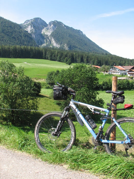
Hier meine Umrundung des Rauschberges. Ich mußte leider einen Umweg in Kauf nehmen, da wegen Baumfällarbeiten eine Verbindung von Schmelz aus gesperrt war - ansonsten eine schöne Tour mit teilweise heftigen Aufstiegen.

Карта маршрута и высотный профиль

  • Open Street Map
  • Google
Minimum height 625 m Maximum height 1144 m Детальный вид

More about the tour author

Ulli1962
Member since 2009

Send private message

Комментарии

GPS-Tracks

Trackpoints
  • GPX / Garmin Map Source (gpx) download
  • TCX / Garmin Training Center® (tcx) download
  • CRS / Garmin Training Center® (crs) download
  • Google Earth (kml) download
  • G7ToWin (g7t) download
  • TTQV (trk) download
  • Overlay (ovl) download
  • Fugawi (txt) download
  • Kompass (DAV) Track (tk) download
  • Формуляр маршрута (pdf) download
  • Original file of the author (gpx) download

More about the tour author

Ulli1962
Member since 2009

Send private message
Share track
Add to my favorites
Remove from my favorites
Edit tags
My score
Rate
Маршрут: Ruhpolding / Umrundung Rauschberg
Вид: Горный велосипед
Длина: 47,0 km
Evaluated on:
Длительность:
Day(s)
Hour(s)
Minute(s)
Оценка: Ландшафт Веселье Кондиция Техника