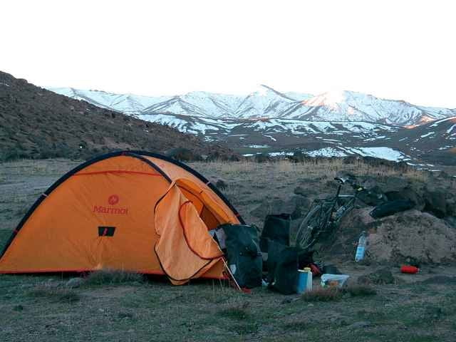
Von Idrgane geht es auf sehr steiler und schwerer Piste entlang eines Bachlaufs hinauf nach Askaoun. Der Marktflecken, der nur selten von Touristen aufgesucht wird, bietet Gelegenheit zu einer zünftigen Brotzeit. Es geht nun weiter auf felsiger, steiler und schmaler Piste bis zur Paßhöhe. Es hat einige Schiebepassagen, nicht fluchen. Einsamkeit und Stille genießen. Schnelle und schöne Abfahrt nach Khouzama. Nun auf welliger, guter Piste nach Anezal, das mit zahlreichen Cafes wiederum zur Rast einlädt. Perfekte Radtour.
Further information at
http://www.cramers-web.deГалерея маршрутов
Карта маршрута и высотный профиль
Minimum height 877 m
Maximum height 2521 m
Комментарии

Marokko ist ein angenehmes Reiseland mit sehr freundlichen Menschen und einem sehr guten Preis-Leistungsverhältnis. Der Flug nach Agadir dauert etwa 4 Stunden und dann geht's sofort los nach Aoulouz. Bitte nicht die Hauptstraße benutzen, siehe Hinweise Homepage
GPS-Tracks
Trackpoints-
GPX / Garmin Map Source (gpx) download
-
TCX / Garmin Training Center® (tcx) download
-
CRS / Garmin Training Center® (crs) download
-
Google Earth (kml) download
-
G7ToWin (g7t) download
-
TTQV (trk) download
-
Overlay (ovl) download
-
Fugawi (txt) download
-
Kompass (DAV) Track (tk) download
-
Формуляр маршрута (pdf) download
Add to my favorites
Remove from my favorites
Edit tags
Open track
My score
Rate


