

Trotz des Starts mehr oder weniger in der Innenstadt, laeuft man die ganze Zeit fern von Autos. Schoene Runde, die trotzdem Kondition abverlangt, da es haeufiger auf und ab geht!
Further information at
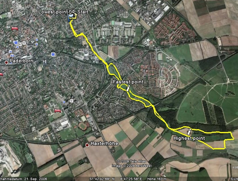
http://www.paderborner-land.de/Карта маршрута и высотный профиль
Minimum height 155 m
Maximum height 259 m
More about the tour author

|
quik-mic |
Комментарии

GPS-Tracks
Trackpoints-
GPX / Garmin Map Source (gpx) download
-
TCX / Garmin Training Center® (tcx) download
-
CRS / Garmin Training Center® (crs) download
-
Google Earth (kml) download
-
G7ToWin (g7t) download
-
TTQV (trk) download
-
Overlay (ovl) download
-
Fugawi (txt) download
-
Kompass (DAV) Track (tk) download
-
Формуляр маршрута (pdf) download
-
Original file of the author (gpx) download
More about the tour author
|
|
quik-mic |
Add to my favorites
Remove from my favorites
Edit tags
Open track
My score
Rate