Login

Забыл пароль?

Cookies have to be accepted!
Your browser's cookie functionality is disabled. Please enable this functionality.

Not a member yet?

Register now
Login

Available for registred users only

Log in to use this feature.

Забыл пароль?

Cookies have to be accepted!
Your browser's cookie functionality is disabled. Please enable this functionality.

Not a member yet?

Register now
Filter
Категории
Advanced filters
  • Длина (км)
  • Высотомер
Сохранить фильтр Reset filter

TrackRank

QRCode

Technical data

Длина80,7 km Высотомер1123 m Way down1079 m Длительность06:00 h:m Дата21.09.2009
Оценки Author User Ландшафт Веселье Кондиция Техника

Статистика

1481 Виды 1 Оценка 119 Загрузки 5.00 Среднее
Rate
  • Формуляр маршрута
  • Дорога
  • Загрузки
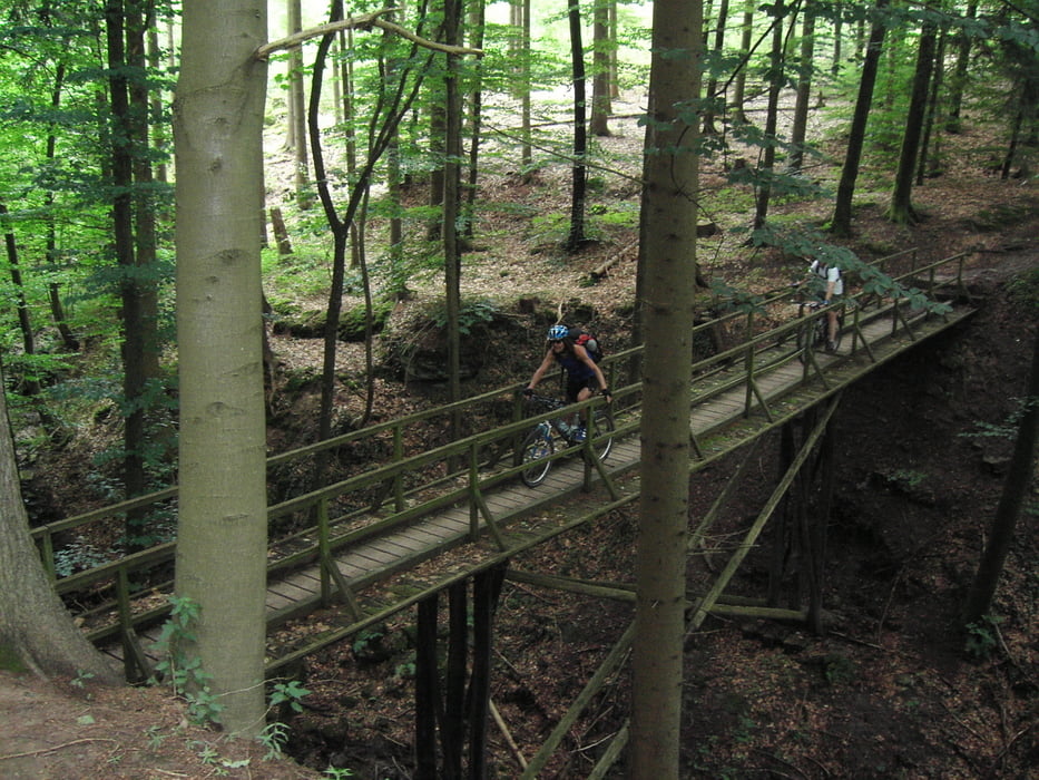
schöne aber auch teiilw. anspruchsvolle Tour zum Ebnissee und wieder zurück. Die 1ste "Halbzeit" zum Ebnisee anspruchsvoller mehr Höhenmeter und auch Trails "nach Hause sprich die 2.te "Halbzeit" kann Mann/Frau es fast gemütlich ausrollen lassen. insgesamt ca. 80KM und 1100HM

Галерея маршрутов

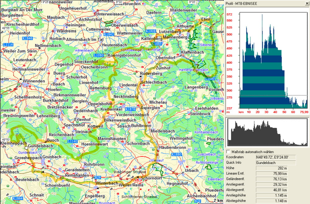
Карта маршрута и высотный профиль

  • Open Street Map
  • Google
Minimum height 205 m Maximum height 544 m Детальный вид

More about the tour author

thkach88
Member since 2009

Send private message

Комментарии

GPS-Tracks

Trackpoints
  • GPX / Garmin Map Source (gpx) download
  • TCX / Garmin Training Center® (tcx) download
  • CRS / Garmin Training Center® (crs) download
  • Google Earth (kml) download
  • G7ToWin (g7t) download
  • TTQV (trk) download
  • Overlay (ovl) download
  • Fugawi (txt) download
  • Kompass (DAV) Track (tk) download
  • Формуляр маршрута (pdf) download
  • Original file of the author (gpx) download

More about the tour author

thkach88
Member since 2009

Send private message
Share track
Add to my favorites
Remove from my favorites
Edit tags
My score
Rate
Маршрут: Waiblingen - Ebnisee
Вид: Горный велосипед
Длина: 80,7 km
Evaluated on:
Длительность:
Day(s)
Hour(s)
Minute(s)
Оценка: Ландшафт Веселье Кондиция Техника