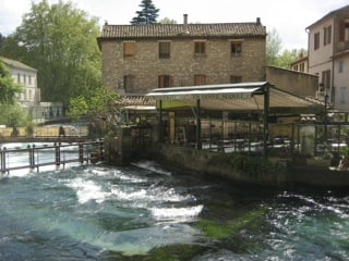
Eine zum teil sehr nette und spassige Angelegenheit zum Teil aber mit dem MTB eine Quälerei, viel Spass beim Nachfahren! Bitte das Höhenprofil beachten! Wir mussten große Passagen schieben! Es fehlten die Technik,, Kondition, Mut! Glücksmomente am Ende, weil man es doch gemacht hat.
Галерея маршрутов
Карта маршрута и высотный профиль
Minimum height 61 m
Maximum height 499 m
Комментарии

GPS-Tracks
Trackpoints-
GPX / Garmin Map Source (gpx) download
-
TCX / Garmin Training Center® (tcx) download
-
CRS / Garmin Training Center® (crs) download
-
Google Earth (kml) download
-
G7ToWin (g7t) download
-
TTQV (trk) download
-
Overlay (ovl) download
-
Fugawi (txt) download
-
Kompass (DAV) Track (tk) download
-
Формуляр маршрута (pdf) download
-
Original file of the author (gpx) download
Add to my favorites
Remove from my favorites
Edit tags
Open track
My score
Rate


