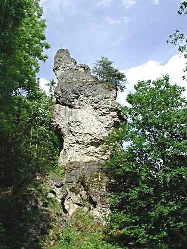
Vom Landhotel Wental aus geht es den Wanderpfad entlang bis zum Wentalweible. Dabei handelt es sich um ein eindrucksvolles Felsmonument, ein Dolomitfelsen, der zur Zeit des Wentalflusses freigewaschen wurde. Die geschah etwa im Bereich von vor 10-2 Millionen Jahren vor unserer Zeit.
Карта маршрута и высотный профиль
Minimum height 590 m
Maximum height 631 m
Комментарии

GPS-Tracks
Trackpoints-
GPX / Garmin Map Source (gpx) download
-
TCX / Garmin Training Center® (tcx) download
-
CRS / Garmin Training Center® (crs) download
-
Google Earth (kml) download
-
G7ToWin (g7t) download
-
TTQV (trk) download
-
Overlay (ovl) download
-
Fugawi (txt) download
-
Kompass (DAV) Track (tk) download
-
Формуляр маршрута (pdf) download
-
Original file of the author (gpx) download
Add to my favorites
Remove from my favorites
Edit tags
Open track
My score
Rate


