

Decir primeramente que la ruta la tomamos de la página Cantabria en bici donde os recomendamos que accedáis para una información mas detallada.
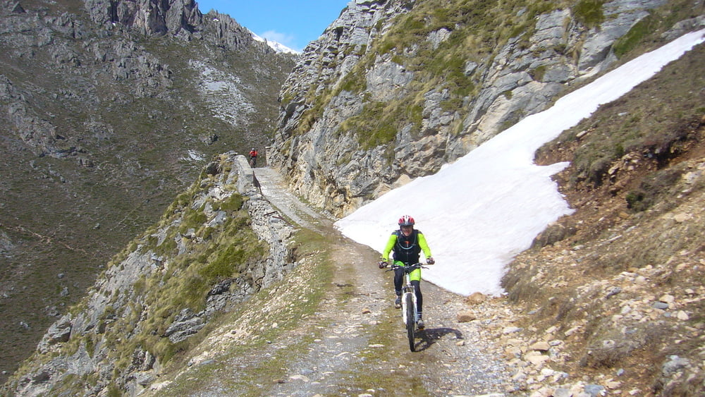
Es una excelente ruta por bosque y praderías de este valle de la zona de Picos de Europa. La pista está en general en buen estado y muy ancha.
La ascensión hacia los puertos de Áliva (a los que no se llegan) es dura, con algun punto de fuerte pendiente, pero que es bien recompensado el esfuerzo con las excelentes vistas de todo el valle.
La bajada es rápida, y actualmente con bastante gravilla suelta.
Галерея маршрутов


Карта маршрута и высотный профиль
Minimum height 570 m
Maximum height 1473 m
More about the tour author
|
|
sergiomf |
Комментарии

Os recomendamos calentar un poco antes de empezar, pues la subida empieza a los pocos metros. En el pueblo de Los llanos hay un buen aparcamiento donde dejar el coche, y en Espinama (a la mitad, antes de la subida mas importante) hay fuente y bar donde tomar una bebida para subir mas animados.
GPS-Tracks
Trackpoints-
GPX / Garmin Map Source (gpx) download
-
TCX / Garmin Training Center® (tcx) download
-
CRS / Garmin Training Center® (crs) download
-
Google Earth (kml) download
-
G7ToWin (g7t) download
-
TTQV (trk) download
-
Overlay (ovl) download
-
Fugawi (txt) download
-
Kompass (DAV) Track (tk) download
-
Формуляр маршрута (pdf) download
-
Original file of the author (gpx) download
More about the tour author
|
|
sergiomf |
Add to my favorites
Remove from my favorites
Edit tags
Open track
My score
Rate