Login

Забыл пароль?

Cookies have to be accepted!
Your browser's cookie functionality is disabled. Please enable this functionality.

Not a member yet?

Register now
Login

Available for registred users only

Log in to use this feature.

Забыл пароль?

Cookies have to be accepted!
Your browser's cookie functionality is disabled. Please enable this functionality.

Not a member yet?

Register now
Filter
Категории
Advanced filters
  • Длина (км)
  • Высотомер
Сохранить фильтр Reset filter

TrackRank

QRCode

Technical data

Длина12,4 km Высотомер635 m Way down597 m Длительность04:00 h:m Дата01.06.2010
Оценки Author User Ландшафт Веселье Кондиция Техника

Статистика

1581 Виды 2 Оценки 219 Загрузки 4.00 Среднее
Rate
  • Формуляр маршрута
  • Дорога
  • Загрузки

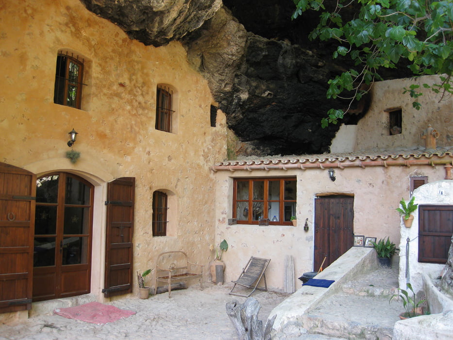
Die Tour führt auf steinigen Wegen und tlw. auch Forststrassen durch das Waldgebirge nördlich von Bunyola. Vom Penyal d´Honor hat man einen schönen Ausblick. Der Rückweg führt durch ein schattiges Tal am Höhlenhaus Sa Cova vorbei zurück nach Bunyola.

Галерея маршрутов

Карта маршрута и высотный профиль

  • Open Street Map
  • Google
Minimum height 211 m Maximum height 805 m Детальный вид

More about the tour author

Puster
Member since 2009

Send private message

Комментарии

Auf der C-711 nach Bunyola zur Kirche in der Orstmitte. Man kann auch mit dem "Roten Blitz" ab Palma zum Bahnhof nach Bunyola fahren und die Tour dort beginnen.

GPS-Tracks

Trackpoints
  • GPX / Garmin Map Source (gpx) download
  • TCX / Garmin Training Center® (tcx) download
  • CRS / Garmin Training Center® (crs) download
  • Google Earth (kml) download
  • G7ToWin (g7t) download
  • TTQV (trk) download
  • Overlay (ovl) download
  • Fugawi (txt) download
  • Kompass (DAV) Track (tk) download
  • Формуляр маршрута (pdf) download
  • Original file of the author (gpx) download

More about the tour author

Puster
Member since 2009

Send private message
Share track
Add to my favorites
Remove from my favorites
Edit tags
My score
Rate
Маршрут: Von Bunyola zum Penyal d´Honor
Вид: Пешеходный туризм
Длина: 12,4 km
Evaluated on:
Длительность:
Day(s)
Hour(s)
Minute(s)
Оценка: Ландшафт Веселье Кондиция Техника