Login

Забыл пароль?

Cookies have to be accepted!
Your browser's cookie functionality is disabled. Please enable this functionality.

Not a member yet?

Register now
Login

Available for registred users only

Log in to use this feature.

Забыл пароль?

Cookies have to be accepted!
Your browser's cookie functionality is disabled. Please enable this functionality.

Not a member yet?

Register now
Filter
Категории
Advanced filters
  • Длина (км)
  • Высотомер
Сохранить фильтр Reset filter

TrackRank

QRCode

Technical data

Длина8,9 km Высотомер389 m Way down365 m Длительность02:00 h:m Дата06.06.2010
Оценки Author Ландшафт Веселье Кондиция Техника

Статистика

856 Виды Оценки 134 Загрузки Среднее
Rate
  • Формуляр маршрута
  • Дорога
  • Загрузки

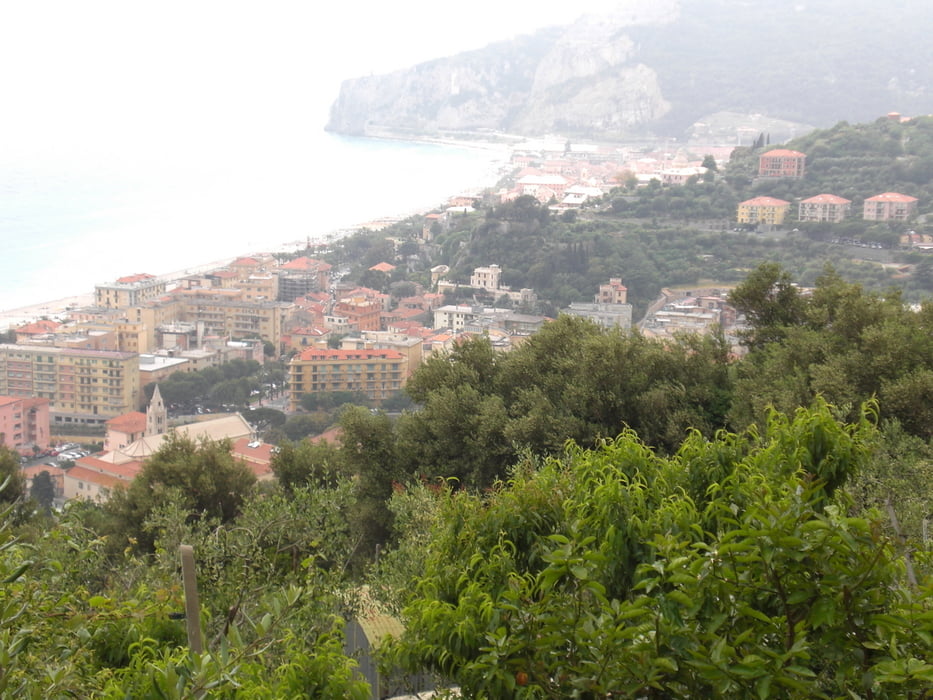
ab der Kirche leicht ansteigender Pfad bis auf ca. 390 hm, dann wieder abwärts. Tour kann mit Kindern begangenwerden. Schöne Aussichtsmöglichkeiten auf Finale Ligure

Карта маршрута и высотный профиль

  • Open Street Map
  • Google
Minimum height 28 m Maximum height 299 m Детальный вид

More about the tour author

Fruehaufsteher
Member since 2008

Send private message

Комментарии

GPS-Tracks

Trackpoints
  • GPX / Garmin Map Source (gpx) download
  • TCX / Garmin Training Center® (tcx) download
  • CRS / Garmin Training Center® (crs) download
  • Google Earth (kml) download
  • G7ToWin (g7t) download
  • TTQV (trk) download
  • Overlay (ovl) download
  • Fugawi (txt) download
  • Kompass (DAV) Track (tk) download
  • Формуляр маршрута (pdf) download
  • Original file of the author (gpx) download

More about the tour author

Fruehaufsteher
Member since 2008

Send private message
Share track
Add to my favorites
Remove from my favorites
Edit tags
My score
Rate
Маршрут: Finale Ligure - Monte Tolla
Вид: Пешеходный туризм
Длина: 8,9 km
Evaluated on:
Длительность:
Day(s)
Hour(s)
Minute(s)
Оценка: Ландшафт Веселье Кондиция Техника