Login

Забыл пароль?

Cookies have to be accepted!
Your browser's cookie functionality is disabled. Please enable this functionality.

Not a member yet?

Register now
Login

Available for registred users only

Log in to use this feature.

Забыл пароль?

Cookies have to be accepted!
Your browser's cookie functionality is disabled. Please enable this functionality.

Not a member yet?

Register now
Filter
Категории
Advanced filters
  • Длина (км)
  • Высотомер
Сохранить фильтр Reset filter

TrackRank

QRCode

Technical data

Длина13,9 km Высотомер291 m Way down299 m Длительность03:00 h:m Дата22.06.2010
Оценки Author Ландшафт Веселье Кондиция Техника

Статистика

288 Виды Оценки 17 Загрузки Среднее
Rate
  • Формуляр маршрута
  • Дорога
  • Загрузки

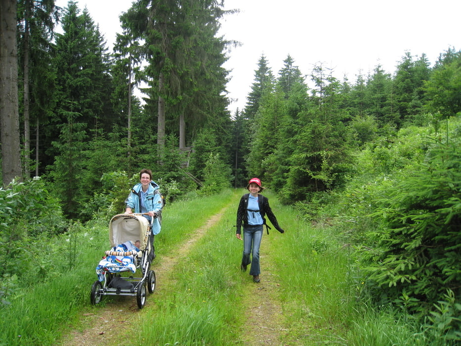
Da wir mit dem Sohn und seinem schiebbaren Untersatz unterwegs waren, mussten wir von der Streckenführung ein bißchen improvisieren, damit seine Mutter nicht k.o. geht. Sie ließ sich kaum helfen...

Галерея маршрутов

Карта маршрута и высотный профиль

  • Open Street Map
  • Google
Minimum height 682 m Maximum height 900 m Детальный вид

More about the tour author

rjkas
Member since 2003

Send private message

Комментарии

GPS-Tracks

Trackpoints
  • GPX / Garmin Map Source (gpx) download
  • TCX / Garmin Training Center® (tcx) download
  • CRS / Garmin Training Center® (crs) download
  • Google Earth (kml) download
  • G7ToWin (g7t) download
  • TTQV (trk) download
  • Overlay (ovl) download
  • Fugawi (txt) download
  • Kompass (DAV) Track (tk) download
  • Формуляр маршрута (pdf) download
  • Original file of the author (gpx) download

More about the tour author

rjkas
Member since 2003

Send private message
Share track
Add to my favorites
Remove from my favorites
Edit tags
My score
Rate
Маршрут: IVV Wandertag 2010 Weitersfelden
Вид: Пешеходный туризм
Длина: 13,9 km
Evaluated on:
Длительность:
Day(s)
Hour(s)
Minute(s)
Оценка: Ландшафт Веселье Кондиция Техника