Login

Забыл пароль?

Cookies have to be accepted!
Your browser's cookie functionality is disabled. Please enable this functionality.

Not a member yet?

Register now
Login

Available for registred users only

Log in to use this feature.

Забыл пароль?

Cookies have to be accepted!
Your browser's cookie functionality is disabled. Please enable this functionality.

Not a member yet?

Register now
Filter
Категории
Advanced filters
  • Длина (км)
  • Высотомер
Сохранить фильтр Reset filter

TrackRank

QRCode

Technical data

Длина14,8 km Высотомер1054 m Way down1026 m Длительность04:45 h:m Дата20.01.2007
Оценки Author Ландшафт Веселье Кондиция Техника

Статистика

1936 Виды Оценки 256 Загрузки Среднее
Rate
  • Формуляр маршрута
  • Дорога
  • Загрузки
Schöne Bergtour mit kleiner Rundtour im Gipfelbereich. Super Fernblick in die Zentralalpen.

Further information at

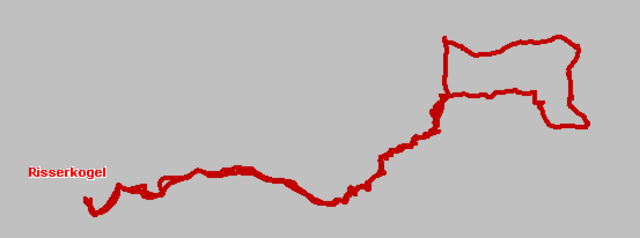
http://www.tourentipp.de/inhalte/touren/detail.asp?id=545

Карта маршрута и высотный профиль

  • Open Street Map
  • Google
Minimum height 787 m Maximum height 1819 m Детальный вид

More about the tour author

klinker

Комментарии

Über Gmund und Kreuth zum Wanderparkplatz an der Schwaigeralm.

GPS-Tracks

Trackpoints
  • GPX / Garmin Map Source (gpx) download
  • TCX / Garmin Training Center® (tcx) download
  • CRS / Garmin Training Center® (crs) download
  • Google Earth (kml) download
  • G7ToWin (g7t) download
  • TTQV (trk) download
  • Overlay (ovl) download
  • Fugawi (txt) download
  • Kompass (DAV) Track (tk) download
  • Формуляр маршрута (pdf) download
  • Original file of the author (gpx) download

More about the tour author

klinker

Share track
Add to my favorites
Remove from my favorites
Edit tags
My score
Rate
Маршрут: Risserkogel
Вид: Горный маршрут
Длина: 14,8 km
Evaluated on:
Длительность:
Day(s)
Hour(s)
Minute(s)
Оценка: Ландшафт Веселье Кондиция Техника