


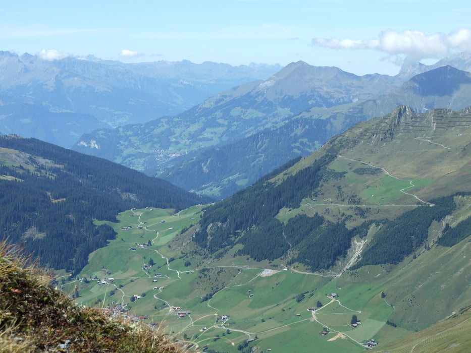
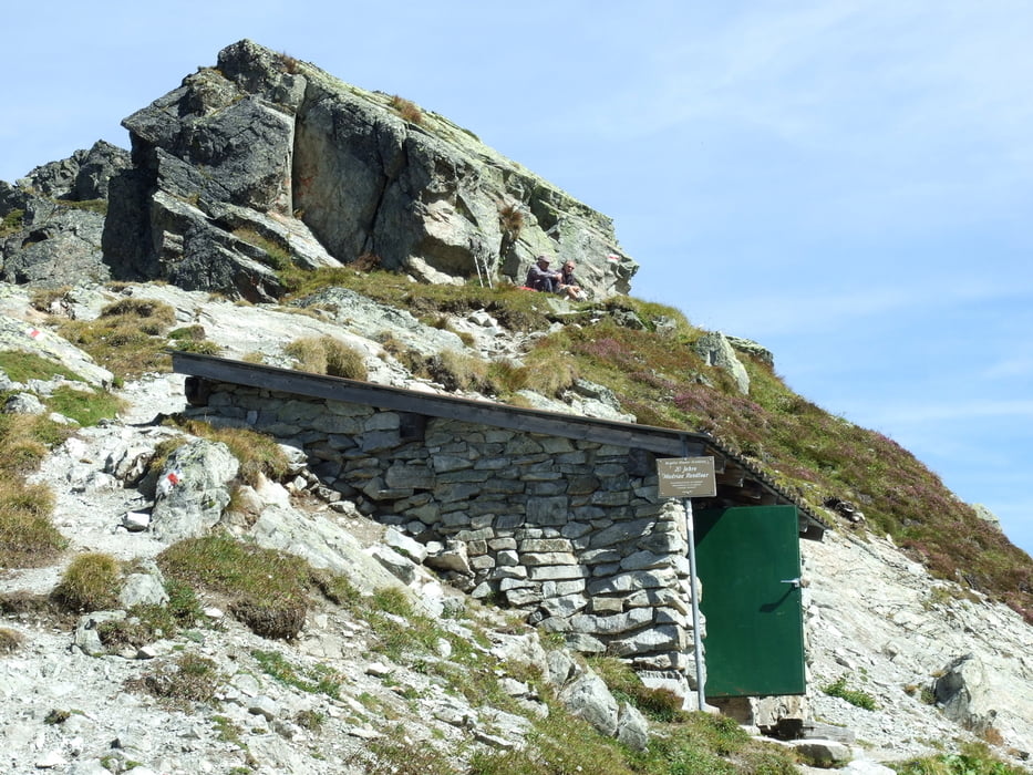
Die Tour startet an der Bergstation Gargellen und über das Antoenier Joch kurz in die Schweiz und dann zur Kirche in Gargellen. Auf dem Joch gibt es eine Schutzhütte.
Die Strecke ist überlaufen und es macht Sinn das Wochenende zu meiden. Stöcke und Bergschuhe sind empfehlenswert.
Gegen Ende der Tour lock die Kesselhütte. Die Hütte hat nur eine kurze Speisekarte, die Gerichte sind aber von guter Qualität.
Further information at
http://www.gargellen.at/Галерея маршрутов


Карта маршрута и высотный профиль
Minimum height 1438 m
Maximum height 2345 m
More about the tour author

|
Комментарии

Es gibt einen kostenlosen Parkplatz an der Talstation der Bergbahn.
GPS-Tracks
Trackpoints-
GPX / Garmin Map Source (gpx) download
-
TCX / Garmin Training Center® (tcx) download
-
CRS / Garmin Training Center® (crs) download
-
Google Earth (kml) download
-
G7ToWin (g7t) download
-
TTQV (trk) download
-
Overlay (ovl) download
-
Fugawi (txt) download
-
Kompass (DAV) Track (tk) download
-
Формуляр маршрута (pdf) download
-
Original file of the author (gpx) download
More about the tour author
|
|
Add to my favorites
Remove from my favorites
Edit tags
Open track
My score
Rate