Login

Забыл пароль?

Cookies have to be accepted!
Your browser's cookie functionality is disabled. Please enable this functionality.

Not a member yet?

Register now
Login

Available for registred users only

Log in to use this feature.

Забыл пароль?

Cookies have to be accepted!
Your browser's cookie functionality is disabled. Please enable this functionality.

Not a member yet?

Register now
Filter
Категории
Advanced filters
  • Длина (км)
  • Высотомер
Сохранить фильтр Reset filter

TrackRank

QRCode

Technical data

Длина65,5 km Высотомер2138 m Way down1237 m Длительность07:15 h:m Дата20.09.2010
Оценки Author User Ландшафт Веселье Кондиция Техника

Статистика

169 Виды 1 Оценка 25 Загрузки 4.00 Среднее
Rate
  • Формуляр маршрута
  • Дорога
  • Загрузки

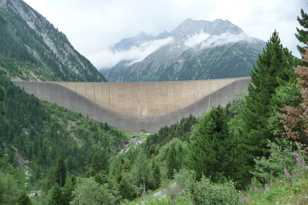
Ein knackiger Berg für den ersten Tag, aber immer gut zu fahren. Nach dem Schlegeisspeicher kommen ein paar Stellen die geschoben werden müssen, je nach Wetterlage.

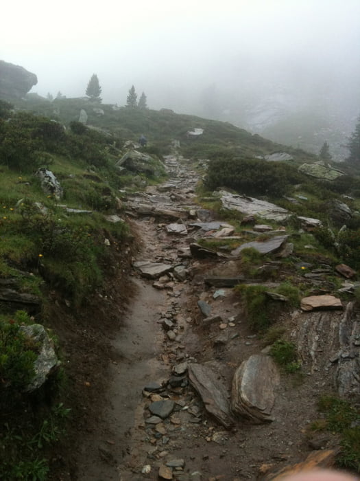
Die Abfahrt ist unspektakulär, bei Regen und Nebel hatte sie es aber trotzdem in sich.


Галерея маршрутов

Карта маршрута и высотный профиль

  • Open Street Map
  • Google
Minimum height 546 m Maximum height 2254 m Детальный вид

More about the tour author

BikeoManiac
Member since 2009

Send private message

Комментарии

GPS-Tracks

Trackpoints
  • GPX / Garmin Map Source (gpx) download
  • TCX / Garmin Training Center® (tcx) download
  • CRS / Garmin Training Center® (crs) download
  • Google Earth (kml) download
  • G7ToWin (g7t) download
  • TTQV (trk) download
  • Overlay (ovl) download
  • Fugawi (txt) download
  • Kompass (DAV) Track (tk) download
  • Формуляр маршрута (pdf) download
  • Original file of the author (gpx) download

More about the tour author

BikeoManiac
Member since 2009

Send private message
Share track
Add to my favorites
Remove from my favorites
Edit tags
My score
Rate
Маршрут: AC Etappe 1 Uderns - St. Jakob
Вид: Горный велосипед
Длина: 65,5 km
Evaluated on:
Длительность:
Day(s)
Hour(s)
Minute(s)
Оценка: Ландшафт Веселье Кондиция Техника