Login

Забыл пароль?

Cookies have to be accepted!
Your browser's cookie functionality is disabled. Please enable this functionality.

Not a member yet?

Register now
Login

Available for registred users only

Log in to use this feature.

Забыл пароль?

Cookies have to be accepted!
Your browser's cookie functionality is disabled. Please enable this functionality.

Not a member yet?

Register now
Filter
Категории
Advanced filters
  • Длина (км)
  • Высотомер
Сохранить фильтр Reset filter

TrackRank

QRCode

Technical data

Длина55,1 km Высотомер1751 m Way down1789 m Длительность00:00 h:m Дата03.10.2010
Оценки Author Ландшафт Веселье Кондиция Техника

Статистика

1069 Виды 1 Оценка 148 Загрузки 1.00 Среднее
Rate
  • Формуляр маршрута
  • Дорога
  • Загрузки

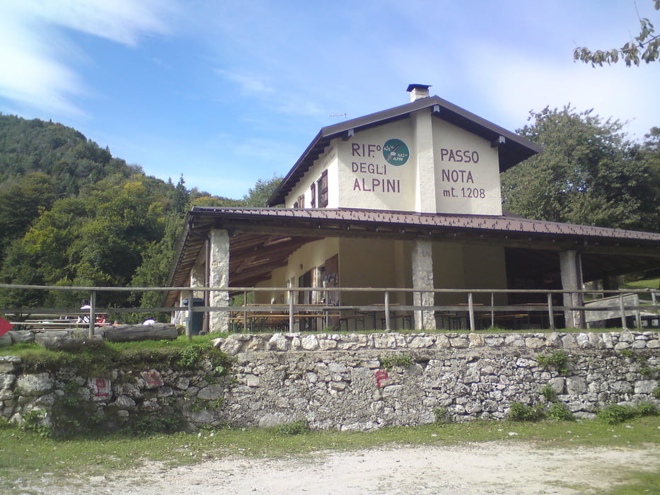
Von Malchesene mit Fähre nach Limone dann rauf zum Pasa Nota und wieder runter RichtungRiva. Von da aus entweder mit Fähre oder wie wir über Haupstraße / Radweg am See zurück nach  Malchesene . 

Галерея маршрутов

Карта маршрута и высотный профиль

  • Open Street Map
  • Google
Minimum height 66 m Maximum height 1298 m Детальный вид

More about the tour author

karl-karlchen
Member since 2010

Send private message

Комментарии

GPS-Tracks

Trackpoints
  • GPX / Garmin Map Source (gpx) download
  • TCX / Garmin Training Center® (tcx) download
  • CRS / Garmin Training Center® (crs) download
  • Google Earth (kml) download
  • G7ToWin (g7t) download
  • TTQV (trk) download
  • Overlay (ovl) download
  • Fugawi (txt) download
  • Kompass (DAV) Track (tk) download
  • Формуляр маршрута (pdf) download
  • Original file of the author (tcx) download

More about the tour author

karl-karlchen
Member since 2010

Send private message
Share track
Add to my favorites
Remove from my favorites
Edit tags
My score
Rate
Маршрут: Gardasee Pasa Nota
Вид: Горный велосипед
Длина: 55,1 km
Evaluated on:
Длительность:
Day(s)
Hour(s)
Minute(s)
Оценка: Ландшафт Веселье Кондиция Техника