Login

Забыл пароль?

Cookies have to be accepted!
Your browser's cookie functionality is disabled. Please enable this functionality.

Not a member yet?

Register now
Login

Available for registred users only

Log in to use this feature.

Забыл пароль?

Cookies have to be accepted!
Your browser's cookie functionality is disabled. Please enable this functionality.

Not a member yet?

Register now
Filter
Категории
Advanced filters
  • Длина (км)
  • Высотомер
Сохранить фильтр Reset filter

TrackRank

QRCode

Technical data

Длина112,9 km Высотомер543 m Way down541 m Длительность04:00 h:m Дата16.04.2011
Оценки Author Ландшафт Веселье Кондиция Техника

Статистика

537 Виды Оценки 39 Загрузки Среднее
Rate
  • Формуляр маршрута
  • Дорога
  • Загрузки
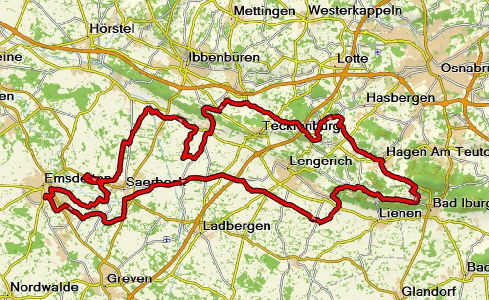
RTF in Emsdetten über 113 km. Mit ein paar schönen Anstiegen im Teutoburger Wald.

Карта маршрута и высотный профиль

  • Open Street Map
  • Google
Minimum height 37 m Maximum height 199 m Детальный вид

More about the tour author

andyderbiker
Member since 2009

Send private message

Комментарии

GPS-Tracks

Trackpoints
  • GPX / Garmin Map Source (gpx) download
  • TCX / Garmin Training Center® (tcx) download
  • CRS / Garmin Training Center® (crs) download
  • Google Earth (kml) download
  • G7ToWin (g7t) download
  • TTQV (trk) download
  • Overlay (ovl) download
  • Fugawi (txt) download
  • Kompass (DAV) Track (tk) download
  • Формуляр маршрута (pdf) download
  • Original file of the author (gpx) download

More about the tour author

andyderbiker
Member since 2009

Send private message
Share track
Add to my favorites
Remove from my favorites
Edit tags
My score
Rate
Маршрут: RTF Emsdetten
Вид: Гоночный велосипед
Длина: 112,9 km
Evaluated on:
Длительность:
Day(s)
Hour(s)
Minute(s)
Оценка: Ландшафт Веселье Кондиция Техника