Login

Забыл пароль?

Cookies have to be accepted!
Your browser's cookie functionality is disabled. Please enable this functionality.

Not a member yet?

Register now
Login

Available for registred users only

Log in to use this feature.

Забыл пароль?

Cookies have to be accepted!
Your browser's cookie functionality is disabled. Please enable this functionality.

Not a member yet?

Register now
Filter
Категории
Advanced filters
  • Длина (км)
  • Высотомер
Сохранить фильтр Reset filter

TrackRank

QRCode

Technical data

Длина17,0 km Высотомер901 m Way down884 m Длительность00:00 h:m Дата11.06.2007
Оценки Author Ландшафт Веселье Кондиция Техника

Статистика

563 Виды Оценки 73 Загрузки Среднее
Rate
  • Формуляр маршрута
  • Дорога
  • Загрузки
Angenehme Tour Von Innerst aus. erst das letzte Stück auf die Hagl Hütte ist etwas steiler.
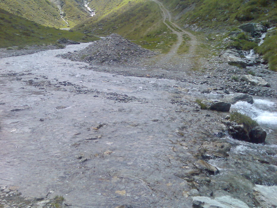
Man muss kurz vor der Hagl Hütte 2x den Bach überqueren,sodaß man nasse Füße bekommt

Галерея маршрутов

Карта маршрута и высотный профиль

  • Open Street Map
  • Google
Minimum height 1265 m Maximum height 2099 m Детальный вид

More about the tour author

tomi
Member since 2005

Send private message

Комментарии

GPS-Tracks

Trackpoints
  • GPX / Garmin Map Source (gpx) download
  • TCX / Garmin Training Center® (tcx) download
  • CRS / Garmin Training Center® (crs) download
  • Google Earth (kml) download
  • G7ToWin (g7t) download
  • TTQV (trk) download
  • Overlay (ovl) download
  • Fugawi (txt) download
  • Kompass (DAV) Track (tk) download
  • Формуляр маршрута (pdf) download
  • Original file of the author (gpx) download

More about the tour author

tomi
Member since 2005

Send private message
Share track
Add to my favorites
Remove from my favorites
Edit tags
My score
Rate
Маршрут: Hagl Hütte
Вид: Горный велосипед
Длина: 17,0 km
Evaluated on:
Длительность:
Day(s)
Hour(s)
Minute(s)
Оценка: Ландшафт Веселье Кондиция Техника