Login

Забыл пароль?

Cookies have to be accepted!
Your browser's cookie functionality is disabled. Please enable this functionality.

Not a member yet?

Register now
Login

Available for registred users only

Log in to use this feature.

Забыл пароль?

Cookies have to be accepted!
Your browser's cookie functionality is disabled. Please enable this functionality.

Not a member yet?

Register now
Filter
Категории
Advanced filters
  • Длина (км)
  • Высотомер
Сохранить фильтр Reset filter

TrackRank

QRCode

Technical data

Длина17,7 km Высотомер242 m Way down243 m Длительность02:00 h:m Дата15.08.2011
Оценки Author Ландшафт Веселье Кондиция Техника

Статистика

1886 Виды Оценки 278 Загрузки Среднее
Rate
  • Формуляр маршрута
  • Дорога
  • Загрузки

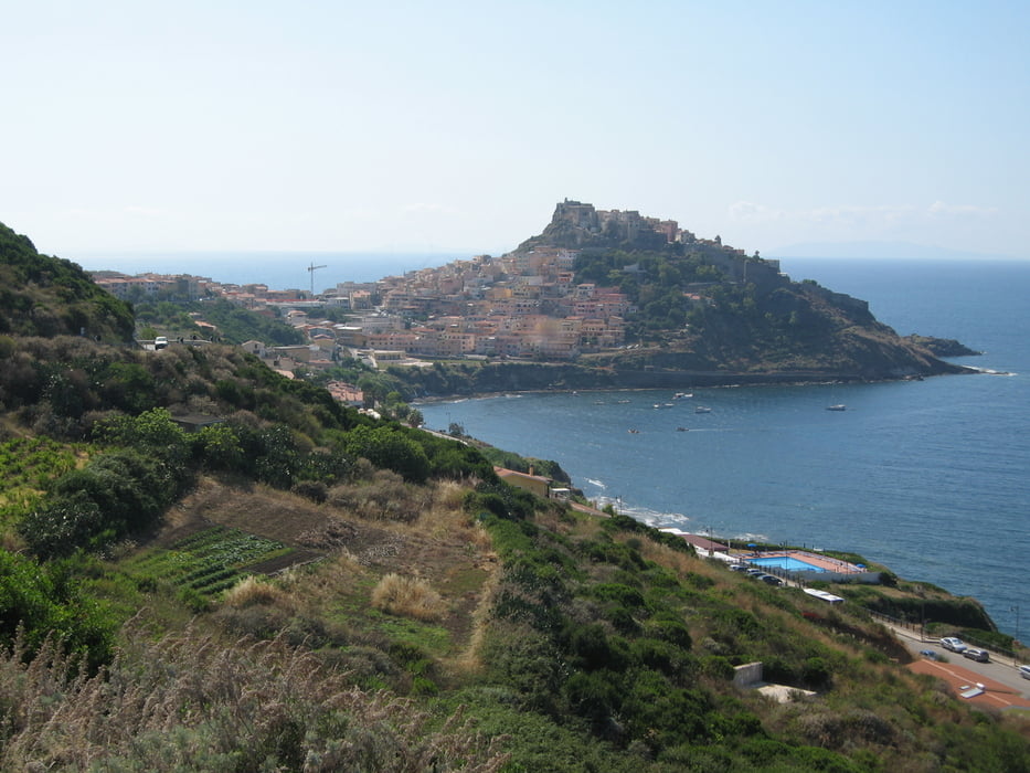
Schöne einfache Tour entlang der Küste auf einen Schotterweg nach Castelsardo. Es lohnt sich ein Besuch der Altstadt.

Zurück auf Asphalt nach Valledoria.

Галерея маршрутов

Карта маршрута и высотный профиль

  • Open Street Map
  • Google
Minimum height 4 m Maximum height 185 m Детальный вид

More about the tour author

Elias Laar
Member since 2006

Send private message

Комментарии

Beginn an der Küste bei Valledoria. ( Campinplatz )

GPS-Tracks

Trackpoints
  • GPX / Garmin Map Source (gpx) download
  • TCX / Garmin Training Center® (tcx) download
  • CRS / Garmin Training Center® (crs) download
  • Google Earth (kml) download
  • G7ToWin (g7t) download
  • TTQV (trk) download
  • Overlay (ovl) download
  • Fugawi (txt) download
  • Kompass (DAV) Track (tk) download
  • Формуляр маршрута (pdf) download
  • Original file of the author (gpx) download

More about the tour author

Elias Laar
Member since 2006

Send private message
Share track
Add to my favorites
Remove from my favorites
Edit tags
My score
Rate
Маршрут: Von Valledoria nach Castelsardo
Вид: Горный велосипед
Длина: 17,7 km
Evaluated on:
Длительность:
Day(s)
Hour(s)
Minute(s)
Оценка: Ландшафт Веселье Кондиция Техника