


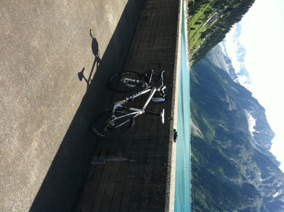
Sehr schöne Tour mit herrlicher Landschaft, mit Ausgangspunkt vom Sporthotel Stock in Finkenberg. Die Tour empfiehlt sich bei schönem Wetter. Ausreichend Getränke mitnehmen, da die erste Auffahrt zur Alm recht gute Kondition erfordert. Entlohnt wird mit einer herrlichen Abfahrt und einem netten Restaurant auf halber Höhe. Der Stausee ist ein absoluter Höhepunkt. Ich empfehle jedoch kleine Front- und Hecklampen mitzunehmen, da einige (wenige) Tunnels durchfahren werden müssen. Viel Spaß
Галерея маршрутов
Карта маршрута и высотный профиль
Minimum height 746 m
Maximum height 1851 m
More about the tour author
|
|
scottbikermuc |
Комментарии

GPS-Tracks
Trackpoints-
GPX / Garmin Map Source (gpx) download
-
TCX / Garmin Training Center® (tcx) download
-
CRS / Garmin Training Center® (crs) download
-
Google Earth (kml) download
-
G7ToWin (g7t) download
-
TTQV (trk) download
-
Overlay (ovl) download
-
Fugawi (txt) download
-
Kompass (DAV) Track (tk) download
-
Формуляр маршрута (pdf) download
-
Original file of the author (gpx) download
More about the tour author
|
|
scottbikermuc |
Add to my favorites
Remove from my favorites
Edit tags
Open track
My score
Rate