

Ausgangspunkt ist die alte Skistation in Haut-Asco (1422 m). Der Wegmarkierung folgen, diese ist manchmal etwas schwer im Geröll zu erkennen, aber insgesamt ist der Weg doch gut erkennbar. Die Wanderung führt zu 90% über Geröll und Felsblöcke und ist auch aufgrund der Tourlänge konditionell anspruchsvoll. Man sollte den Abstieg nicht unterschätzen.
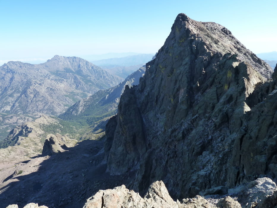
Bei schönem Wetter jedoch genialer Rundumblick vom Gipfel, bis zum Meer. Es lohnt sich!!
Карта маршрута и высотный профиль
Minimum height 1409 m
Maximum height 2697 m
More about the tour author

|
B_Kalli |
Комментарии

Über das Asco-Tal nach Haut-Asco, alte Skistation (Parkplätze vorhanden)
GPS-Tracks
Trackpoints-
GPX / Garmin Map Source (gpx) download
-
TCX / Garmin Training Center® (tcx) download
-
CRS / Garmin Training Center® (crs) download
-
Google Earth (kml) download
-
G7ToWin (g7t) download
-
TTQV (trk) download
-
Overlay (ovl) download
-
Fugawi (txt) download
-
Kompass (DAV) Track (tk) download
-
Формуляр маршрута (pdf) download
-
Original file of the author (gpx) download
More about the tour author
|
|
B_Kalli |
Add to my favorites
Remove from my favorites
Edit tags
Open track
My score
Rate