Login

Забыл пароль?

Cookies have to be accepted!
Your browser's cookie functionality is disabled. Please enable this functionality.

Not a member yet?

Register now
Login

Available for registred users only

Log in to use this feature.

Забыл пароль?

Cookies have to be accepted!
Your browser's cookie functionality is disabled. Please enable this functionality.

Not a member yet?

Register now
Filter
Категории
Advanced filters
  • Длина (км)
  • Высотомер
Сохранить фильтр Reset filter

TrackRank

QRCode

Technical data

Длина65,3 km Высотомер2240 m Way down2235 m Длительность05:52 h:m Дата01.12.2011
Оценки Author Ландшафт Веселье Кондиция Техника

Статистика

359 Виды Оценки 58 Загрузки Среднее
Rate
  • Формуляр маршрута
  • Дорога
  • Загрузки

Steinfeld-Tröbelsberg-NagglerAlm-Kohlröslhütte-Radnig-
RadnigerAlm-Bodenalm-Weißensee-Steinfeld

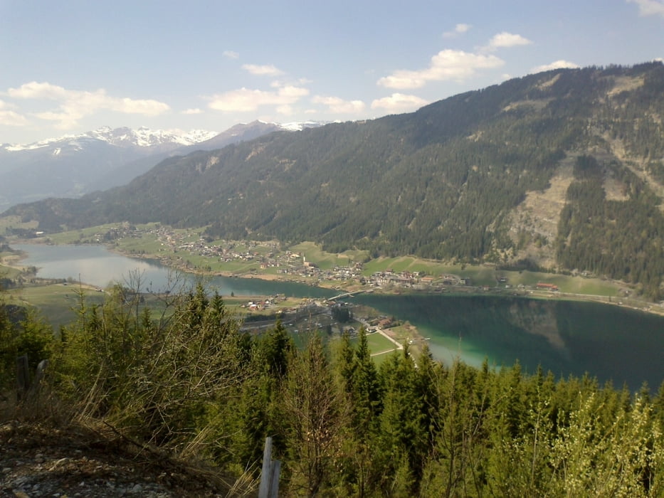
Sensationelle Runde mit einigen Verfahrern. Der Anstieg zur
Radniger Alm ist großartig.
 

Галерея маршрутов

Карта маршрута и высотный профиль

  • Open Street Map
  • Google
Minimum height 574 m Maximum height 1562 m Детальный вид

Комментарии

Steinfeld: Brücke Drauradweg

GPS-Tracks

Trackpoints
  • GPX / Garmin Map Source (gpx) download
  • TCX / Garmin Training Center® (tcx) download
  • CRS / Garmin Training Center® (crs) download
  • Google Earth (kml) download
  • G7ToWin (g7t) download
  • TTQV (trk) download
  • Overlay (ovl) download
  • Fugawi (txt) download
  • Kompass (DAV) Track (tk) download
  • Формуляр маршрута (pdf) download
  • Original file of the author (gpx) download
Share track
Add to my favorites
Remove from my favorites
Edit tags
My score
Rate
Маршрут: Weißensee Süd
Вид: Горный велосипед
Длина: 65,3 km
Evaluated on:
Длительность:
Day(s)
Hour(s)
Minute(s)
Оценка: Ландшафт Веселье Кондиция Техника