
")

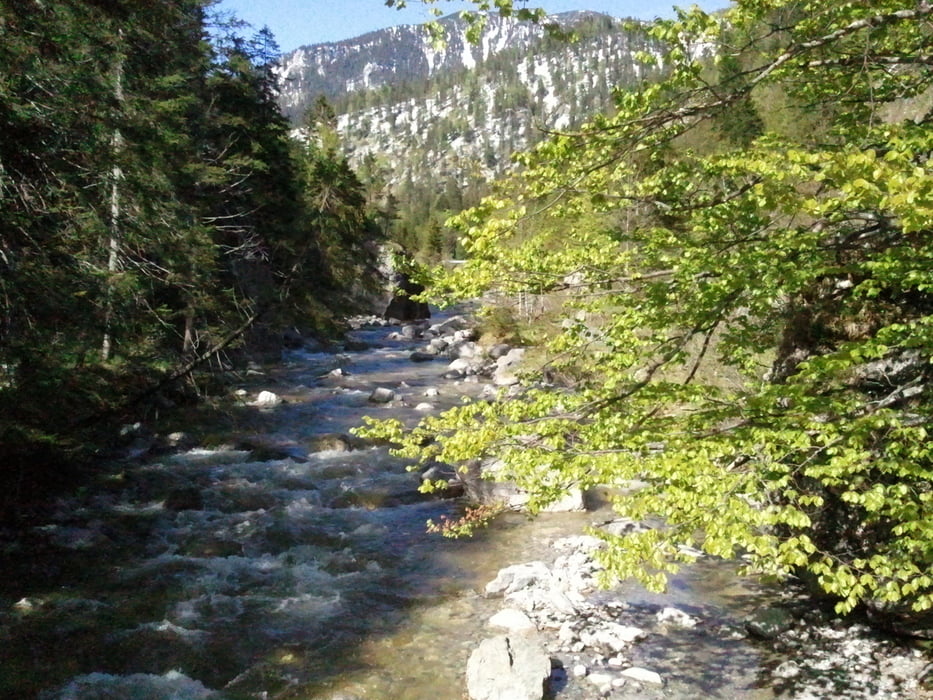
Die Tour führ über uns über die Rapinschlucht auf den Rabenkopf (1559m). Auf Grund der langen Strecke ist eine gute Ausdauer hilfreich. Der Weg durch die Rapinschlucht ist gut befestigt und ohne technische Herausforderung begehbar, erfordert aber einge gewisse Schwindelfreiheit wegen sehr steilen Hänge unmittelbar neben dem Weg. Bei rutschiger Witterung (Schnee, Eis) sollte auf diesen Weg verzichtet werden.
Die Staffelalm ist in den Sommermonaten bewirtet und bietet eine kleine Brotzeit oder Kaffee und Kuchen.
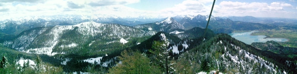
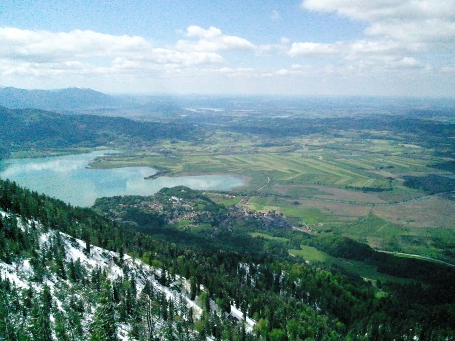
Der Rabenkopf ist ohne Schwierigkeiten begehbar und bietet eine phantastische Aussicht auf Kochelsee, Starnberger See und in Richtung München.
Der Rückweg kann im Sommer durch einen Bergpfad abgekürzt werden. Wir sind wegen frischem Schnee (Mitte Mai 2012!) den etwas längeren Fahrweg gegangen, der Abzweig ist jedoch als Wegpunkt im Track angegeben.
Further information at
http://www.kochel.de/index.php?id=2229,6galéria trás

Mapa trasy a výškový profil
Minimum height 777 m
Maximum height 1552 m
More about the tour author
|
|
klaus62 |
komentáre

Mit dem Auto bis Jachenau. Dort auf dem kostenlosen Wanderparkplatz parken. Von hier beginnt der GPS-Track.
GPS trasy
Trackpoints-
GPX / Garmin Map Source (gpx) download
-
TCX / Garmin Training Center® (tcx) download
-
CRS / Garmin Training Center® (crs) download
-
Google Earth (kml) download
-
G7ToWin (g7t) download
-
TTQV (trk) download
-
Overlay (ovl) download
-
Fugawi (txt) download
-
Kompass (DAV) Track (tk) download
-
list trasy (pdf) download
-
Original file of the author (gpx) download
More about the tour author
|
|
klaus62 |
Add to my favorites
Remove from my favorites
Edit tags
Open track
My score
Rate