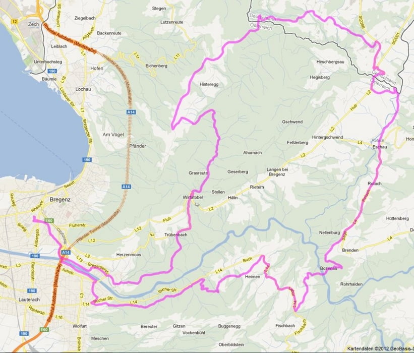
abwechslungsreiche Tour am Pfänder und durch den Vorderwald, größtenteils auf Waldwegen und Trails, Asphalt nur dort wo es keine Alternative im Gelände gibt
Mapa trasy a výškový profil
Minimum height 386 m
Maximum height 1020 m
komentáre
Start und Ziel: Bregenz
GPS trasy
Trackpoints-
GPX / Garmin Map Source (gpx) download
-
TCX / Garmin Training Center® (tcx) download
-
CRS / Garmin Training Center® (crs) download
-
Google Earth (kml) download
-
G7ToWin (g7t) download
-
TTQV (trk) download
-
Overlay (ovl) download
-
Fugawi (txt) download
-
Kompass (DAV) Track (tk) download
-
list trasy (pdf) download
-
Original file of the author (gpx) download
Add to my favorites
Remove from my favorites
Edit tags
Open track
My score
Rate


Gefahren am 22.08.2014
Fazit: Die Tour passt leider nicht zur Streckenbeschreibung: "Asphalt nur wo es keine Alternativen im Gelände gibt" stimmt hier leider nicht.