

Vom Parkplatz des Hotels Donau Schlinge auf der Bundesstrasse Richtung Eferding.
Nach ca. 500m scharf rechts bergauf Richtung Enzing - St. Agatha.
Vorbei am Stefan Fadinger Hof und dem Skilift in Agatha.
Beim Fahrverbot ( Forstweg ca. 1 km schieben ;-) )
Hinunter an die Bundesstrasse und auf der anderen Seite in den Wald Richtung Haibach.
In Haibach dem Wanderweg Steiner Felsen folgen.
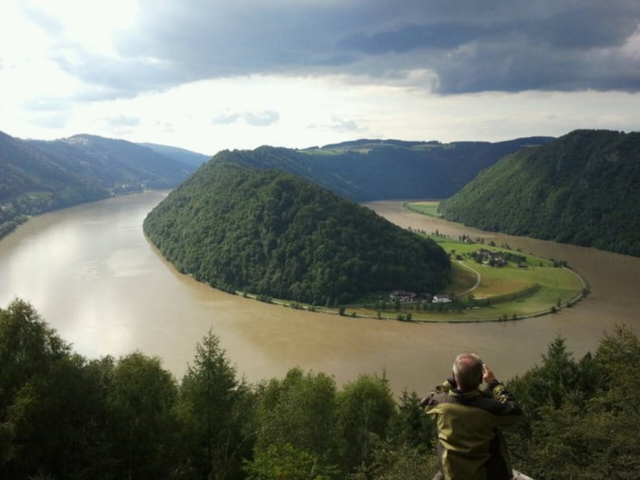
Eine TOLLE AUSSICHT beim Steiner Felsen und beim Schlögener Blick ist die Belohnung
für die schöne Tour.
Viel Spaß.
Mapa trasy a výškový profil
Minimum height 256 m
Maximum height 631 m
More about the tour author
|
|
bikenik |
komentáre

GPS trasy
Trackpoints-
GPX / Garmin Map Source (gpx) download
-
TCX / Garmin Training Center® (tcx) download
-
CRS / Garmin Training Center® (crs) download
-
Google Earth (kml) download
-
G7ToWin (g7t) download
-
TTQV (trk) download
-
Overlay (ovl) download
-
Fugawi (txt) download
-
Kompass (DAV) Track (tk) download
-
list trasy (pdf) download
-
Original file of the author (gpx) download
More about the tour author
|
|
bikenik |
Add to my favorites
Remove from my favorites
Edit tags
Open track
My score
Rate