


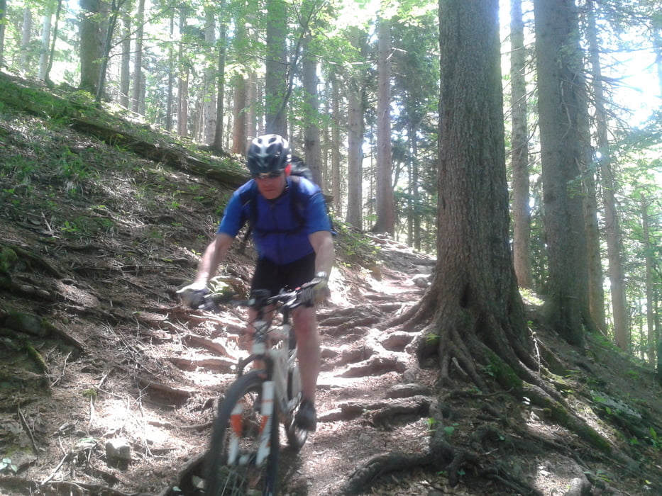
Schöne Tour mit teilwese steilen Auffahrten und schönen Waldtrails.
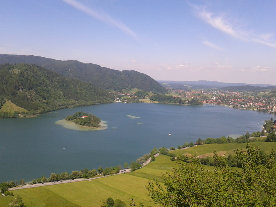
Erst geht es auf einem Forstweg auf den Schliersberg, von da aus auf einem Waldtrail wieder bergab. An einer Wegkreuzung des Trails (da steht eine Bank) geht es links, kurz danach auf einem Holzbohlenpfad über eine Bergwiese. Dann wieder über Forstwege, teilweise steil, bis man am Ende auf einen Waldpfad stösst. Hier kann man nach links einen Abstecher zur RUine Hohenwaldeck machen, allerdings besser zu Fuss, da der Weg zurück nicht wirklich fahrbar ist. Weiter in Richtung der Tour kommt man auf einen Wiesentrail mit fantastischen Blicken auf den Schliersee.
galéria trás
Mapa trasy a výškový profil
Minimum height 774 m
Maximum height 1195 m
More about the tour author

|
MadMario |
komentáre
Anfahrt nach Schliersee über die A8, Ausfahrt Weyarn, dann Richtung Süden. Start ist in Schliersee an der Kirche in der Mesnergasse.
GPS trasy
Trackpoints-
GPX / Garmin Map Source (gpx) download
-
TCX / Garmin Training Center® (tcx) download
-
CRS / Garmin Training Center® (crs) download
-
Google Earth (kml) download
-
G7ToWin (g7t) download
-
TTQV (trk) download
-
Overlay (ovl) download
-
Fugawi (txt) download
-
Kompass (DAV) Track (tk) download
-
list trasy (pdf) download
-
Original file of the author (gpx) download
More about the tour author
|
|
MadMario |
Add to my favorites
Remove from my favorites
Edit tags
Open track
My score
Rate
Forstautobahntour
Gibt es deutlich schönere Touren in der Gegend.