Login

Zabudli ste prihlasovacia meno

Cookies have to be accepted!
Your browser's cookie functionality is disabled. Please enable this functionality.

Not a member yet?

Register now
Login

Available for registred users only

Log in to use this feature.

Zabudli ste prihlasovacia meno

Cookies have to be accepted!
Your browser's cookie functionality is disabled. Please enable this functionality.

Not a member yet?

Register now
Filter
Kategórie
Advanced filters
  • Dĺžka (km)
  • výškomer
Uložiť filter Reset filter

TrackRank

QRCode

Technical data

Dĺžka54,8 km výškomer716 m Way down719 m Doba04:30 h:m dátum13.06.2012
ohodnotenia Author Kraj pôžitok z túry kondícia technika

štatistika

1674 náhľady ohodnotenia 491 Stiahnutia priemer
Rate
  • list trasy
  • príjazd
  • Stiahnutia

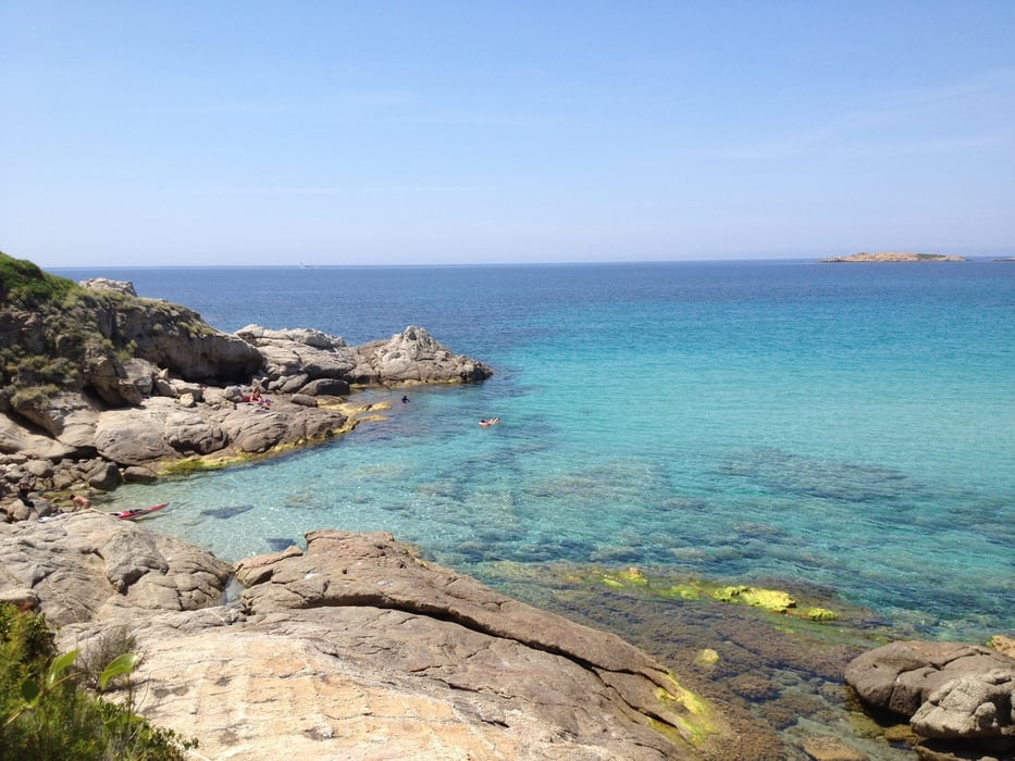
Diese Tour kommt mit wenig Höhenmeter dafür aber mit geilen Trails und Hammer-Panorama auf das türkis-grüne Meer aus. Dieser Küstenstreifen ist durchzogen von handtuchbreiten Trail´s.Wenn sich auf dieser Strecke eine Alternative bietet, (und da gibt es gar viele) dann testen irgendwann ist man schon wieder auf dem Track. Von CC Bis FR ist alles drinn, fahren und geniesen.

Viel Spass!

galéria trás

Mapa trasy a výškový profil

  • Open Street Map
  • Google
Minimum height 1 m Maximum height 129 m Detailný pohľad

More about the tour author

berndhuber
Member since 2008

Send private message

komentáre

Calvi>Camp Raffalli>3.links

GPS trasy

Trackpoints
  • GPX / Garmin Map Source (gpx) download
  • TCX / Garmin Training Center® (tcx) download
  • CRS / Garmin Training Center® (crs) download
  • Google Earth (kml) download
  • G7ToWin (g7t) download
  • TTQV (trk) download
  • Overlay (ovl) download
  • Fugawi (txt) download
  • Kompass (DAV) Track (tk) download
  • list trasy (pdf) download
  • Original file of the author (gpx) download

More about the tour author

berndhuber
Member since 2008

Send private message
Share track
Add to my favorites
Remove from my favorites
Edit tags
My score
Rate
trasa: Küstentrails
Druh: horský bicykel
Dĺžka: 54,8 km
Evaluated on:
Doba:
Day(s)
Hour(s)
Minute(s)
ohodnotenie: Kraj pôžitok z túry kondícia technika