
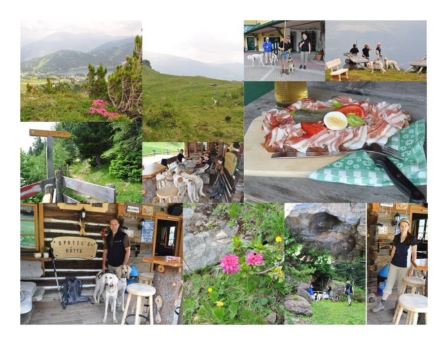

Die Wanderung ist sehr gut beschildert und beginnt einige Meter oberhalb des Nocky-Flitzers. Die Strecke führt am Hang entlang durch die Lawinenverbauung.
Nach ca. einer 1/2 Stunde erreicht man ein Tal mit der verfallenen Korhütte und dem Quecksilberbergwerk. Das Panorama hin zum Rinsennock und zum Kornnock ist überwältigend!
Vorbei an unzähligen kleinen Seen steigt man nun auf den Aussichtspunkt auf. Von hier aus hat man eine wunderbare Aussicht über die Turracherhöhe.
Der Abstieg führt über die Hänge des Hirschenkogels hinunter nach Turrach.
Ein perfekter Einkehrschwung in der Spatzlhütte rundet die wunderschöne Wanderung ab.
Further information at
http://www.seehotel-jaegerwirt.at/Mapa trasy a výškový profil
Minimum height 1761 m
Maximum height 2100 m
More about the tour author
|
|
huberj59 |
komentáre

Unser Startpunkt war unser Hotel Jägerwirt. Doch beim Nocky-Flitzer gibt es jede Menge Parkplätze. Dort startet auch die eigentliche Barbara-Wanderderung.
GPS trasy
Trackpoints-
GPX / Garmin Map Source (gpx) download
-
TCX / Garmin Training Center® (tcx) download
-
CRS / Garmin Training Center® (crs) download
-
Google Earth (kml) download
-
G7ToWin (g7t) download
-
TTQV (trk) download
-
Overlay (ovl) download
-
Fugawi (txt) download
-
Kompass (DAV) Track (tk) download
-
list trasy (pdf) download
-
Original file of the author (gpx) download
More about the tour author
|
|
huberj59 |
Add to my favorites
Remove from my favorites
Edit tags
Open track
My score
Rate