


Eine wunderbar abwechslungsreiche und anspruchvolle Tour mit dem Ausgangspunkt in Torbole.
Los geht's am Kreisverkehr in Torbole über die ruhige Nebenstraße hinaus nach Nago. Vor dort aus durch die Stadt über Radwege über Loppio nach Mori und weiter Richtung Rovereto. Vor allem das flache Teilstück entlang der Etsch ist landschatlich sehr schön.
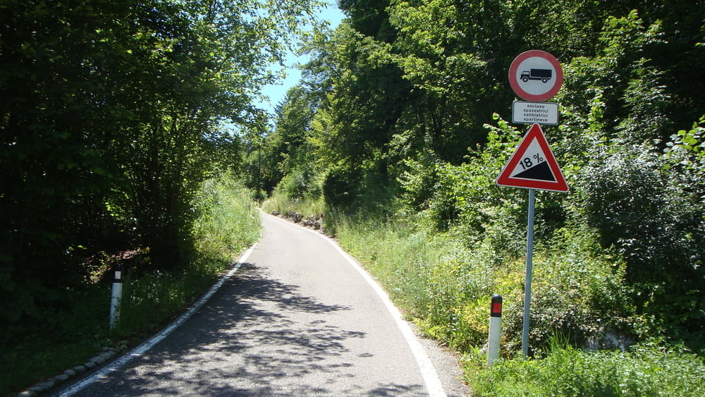
Am Kreisverkehr auf dem Platz in Borgo Sacco geht es dann so langsam bergauf. Richtung Westen über die Autobahn und dann der Einstieg über das Örtchen Isera. Weiter bis nach Lenzima und dann noch die letzten Kilometer auf einer engen aber gut asphaltierten Straße mit bis zu 18% auf den Monte Fae.
Vor dort geht es wieder über eine abwechlungsreiche Abfahrt bergab über Valle S. Felice bis nach Loppio. Ab da an wieder über die Radwege nach Nago und die Panoramastraße hinnunter nach Torbole.
galéria trás


Mapa trasy a výškový profil
Minimum height 115 m
Maximum height 975 m
More about the tour author
|
|
mrwaxx |
komentáre

Einstieg in die Tour von überall aus möglich.
GPS trasy
Trackpoints-
GPX / Garmin Map Source (gpx) download
-
TCX / Garmin Training Center® (tcx) download
-
CRS / Garmin Training Center® (crs) download
-
Google Earth (kml) download
-
G7ToWin (g7t) download
-
TTQV (trk) download
-
Overlay (ovl) download
-
Fugawi (txt) download
-
Kompass (DAV) Track (tk) download
-
list trasy (pdf) download
-
Original file of the author (gpx) download
More about the tour author
|
|
mrwaxx |
Add to my favorites
Remove from my favorites
Edit tags
Open track
My score
Rate