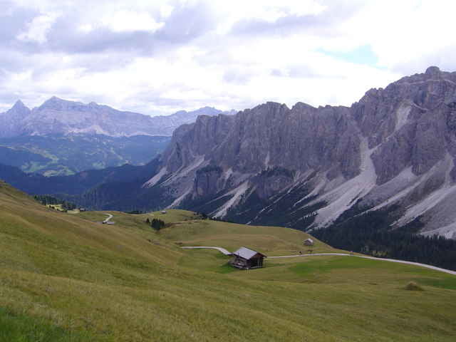
Vom Parkplatz vor der Kirche in St. Martin in Thurn (1150m, Gadertal)fuhren wir auf Asphalt ins Campilltal. Bei km 7.1 (1480 hm) zweigten wir vor dem Reitstall rechts in eine gute Schotterstraße die uns stetig steigend bis zu einer Hütte brachte. Von dort ging es in einer kurzen Tragepassage aufs Kreutzjoch und über einen schönen Trail über Bergwiesen zum Bronsoijoch (2421 m Seehöhe). Kurz etwas ausgesetzt, und tw. fahrbar zum Kreuzkofeljoch-hinunter und zur Schlüterhütte (2306m)-über trail Nr. 35 zu den Peitlerwiesen/Malga
Vaciara. Vom Gömajoch über Wanderweg Nr35 (durchgehend befahrbar) hinunter zur Würzjochstraße zwischen Antermoi und St. Martin. Ein wahres Singletrail Erlebniss! Der von uns zuerst gewählte Wanderweg 9 für die Trail-Abfahrt nach St. Martin (siehe Track) ist auf Grund des extrem ausgesetzten Geländes lebensgefährlich und nicht zu empfehlen.
Vaciara. Vom Gömajoch über Wanderweg Nr35 (durchgehend befahrbar) hinunter zur Würzjochstraße zwischen Antermoi und St. Martin. Ein wahres Singletrail Erlebniss! Der von uns zuerst gewählte Wanderweg 9 für die Trail-Abfahrt nach St. Martin (siehe Track) ist auf Grund des extrem ausgesetzten Geländes lebensgefährlich und nicht zu empfehlen.
galéria trás
Mapa trasy a výškový profil
Minimum height 1122 m
Maximum height 2427 m
komentáre
Wir waren bei unserem Bike-Camp (USI-Biken) im Sporthotel Exclusive (www.sporthotel-exclusive.com) untergebracht. Freundliches Personal - super Service -hervorragende Küche! Kann ich nur weiterempfehlen!
GPS trasy
Trackpoints-
GPX / Garmin Map Source (gpx) download
-
TCX / Garmin Training Center® (tcx) download
-
CRS / Garmin Training Center® (crs) download
-
Google Earth (kml) download
-
G7ToWin (g7t) download
-
TTQV (trk) download
-
Overlay (ovl) download
-
Fugawi (txt) download
-
Kompass (DAV) Track (tk) download
-
list trasy (pdf) download
-
Original file of the author (gpx) download
Add to my favorites
Remove from my favorites
Edit tags
Open track
My score
Rate


Geniale Tour
Tipp mit Weg 35 war gut, doch auch der 35er stellt z.T. hohe Ansprüche an die Fahrtechnik.
Einfach eine klasse Tour, die jeder fahren sollte, der in der Nähe des Gadertals unterwegs ist. Super!