


Von Gramias, in einem Seitental des Lechtals auf 1350 m gelegen, flott und z. T. steil auf kleinem Asphaltsträsschen runter zum Lech auf ca. 1000 m.
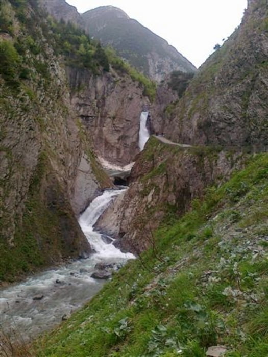
Easy aber in schöner Landschaft auf dem Lechtalradweg (teils Asphalt, teils Schotter) weiter bis Holzgau. Unter der neuen spektakulären Hängebrücke hindurch die Schlucht am Höhenbach entlang hinauf. Vor allem am Wasserfall teilweise sehr steil aber ohne größeren technischen Herausforderungen.
Auf der Roßgumpenalpe ist man dann wieder auf etwa 1350 m und sollte bei genialer Aussicht eine Rast einlegen (die Speck-Jause und das Omlett sind super!)
Je nach Schneemenge variiert die Öffnung der Roßgumpenalpe im Frühjahr. Besser vorher vom Tal aus anrufen. Die Tel.-Nr. steht auf dem Schild am Eingang zur Höhenbachschlucht.
Nehmt Rücksicht auf das wandernde Fußvolk!
Hab leider noch keine echte Alternative zur Asphaltstrasse nach Gramais gefunden und bin für Tips zu fahrbaren Varianten sowie zu weiteren Touren in diesem Gebiet dankbar!
galéria trás


Mapa trasy a výškový profil
Minimum height 1007 m
Maximum height 1386 m
More about the tour author

|
hotchillyred |
komentáre

GPS trasy
Trackpoints-
GPX / Garmin Map Source (gpx) download
-
TCX / Garmin Training Center® (tcx) download
-
CRS / Garmin Training Center® (crs) download
-
Google Earth (kml) download
-
G7ToWin (g7t) download
-
TTQV (trk) download
-
Overlay (ovl) download
-
Fugawi (txt) download
-
Kompass (DAV) Track (tk) download
-
list trasy (pdf) download
-
Original file of the author (gpx) download
More about the tour author
|
|
hotchillyred |
Add to my favorites
Remove from my favorites
Edit tags
Open track
My score
Rate