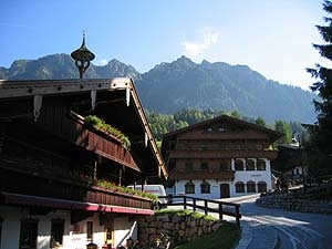
Ausgangspunkt ist der Parkplatz oberhalb des Zottahofes in Alpbach. Hier geht es rauf auf die Hösl Kapelle auf den Gratlspitz. Von der Gratlspitze geht es runter auf die Holzalm, Bischoferalm und wieder zurück zum Hösljoch.
Mapa trasy a výškový profil
Minimum height 1170 m
Maximum height 1906 m
komentáre

über die A12 der Inntalautobahn, Ausfahrt Kramsach, Brixlegg, Alpbach, Zottahof
GPS trasy
Trackpoints-
GPX / Garmin Map Source (gpx) download
-
TCX / Garmin Training Center® (tcx) download
-
CRS / Garmin Training Center® (crs) download
-
Google Earth (kml) download
-
G7ToWin (g7t) download
-
TTQV (trk) download
-
Overlay (ovl) download
-
Fugawi (txt) download
-
Kompass (DAV) Track (tk) download
-
list trasy (pdf) download
-
Original file of the author (gpx) download
Add to my favorites
Remove from my favorites
Edit tags
Open track
My score
Rate


