Login

Zabudli ste prihlasovacia meno

Cookies have to be accepted!
Your browser's cookie functionality is disabled. Please enable this functionality.

Not a member yet?

Register now
Login

Available for registred users only

Log in to use this feature.

Zabudli ste prihlasovacia meno

Cookies have to be accepted!
Your browser's cookie functionality is disabled. Please enable this functionality.

Not a member yet?

Register now
Filter
Kategórie
Advanced filters
  • Dĺžka (km)
  • výškomer
Uložiť filter Reset filter

TrackRank

QRCode

Technical data

Dĺžka53,2 km výškomer1509 m Way down1525 m Doba04:15 h:m dátum31.01.2013
ohodnotenia Author Kraj pôžitok z túry kondícia technika

štatistika

379 náhľady ohodnotenia 51 Stiahnutia priemer
Rate
  • list trasy
  • príjazd
  • Stiahnutia

Hard bis Weißfluhalpe ca. 2h 45 min

Weißfluhalpe bis Hard ca. 1h 30 min

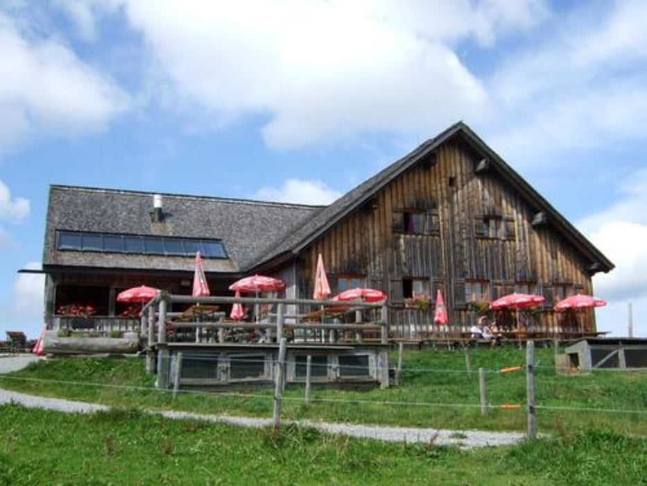
Schöne Einkehrmöglichkeit Weißfluhalpe, sehr schöne Aussicht in alle Richtungen

galéria trás

Mapa trasy a výškový profil

  • Open Street Map
  • Google
Minimum height 388 m Maximum height 1372 m Detailný pohľad

More about the tour author

obuechele
Member since 2012

Send private message

komentáre

GPS trasy

Trackpoints
  • GPX / Garmin Map Source (gpx) download
  • TCX / Garmin Training Center® (tcx) download
  • CRS / Garmin Training Center® (crs) download
  • Google Earth (kml) download
  • G7ToWin (g7t) download
  • TTQV (trk) download
  • Overlay (ovl) download
  • Fugawi (txt) download
  • Kompass (DAV) Track (tk) download
  • list trasy (pdf) download
  • Original file of the author (gpx) download

More about the tour author

obuechele
Member since 2012

Send private message
Share track
Add to my favorites
Remove from my favorites
Edit tags
My score
Rate
trasa: Hard-Weißfluhalpe
Druh: horský bicykel
Dĺžka: 53,2 km
Evaluated on:
Doba:
Day(s)
Hour(s)
Minute(s)
ohodnotenie: Kraj pôžitok z túry kondícia technika