


Die Wanderung entspricht der Wanderung 29 im Rother Wanderführer Ibiza/Fromentera, dort auch die genaue Beschreibung
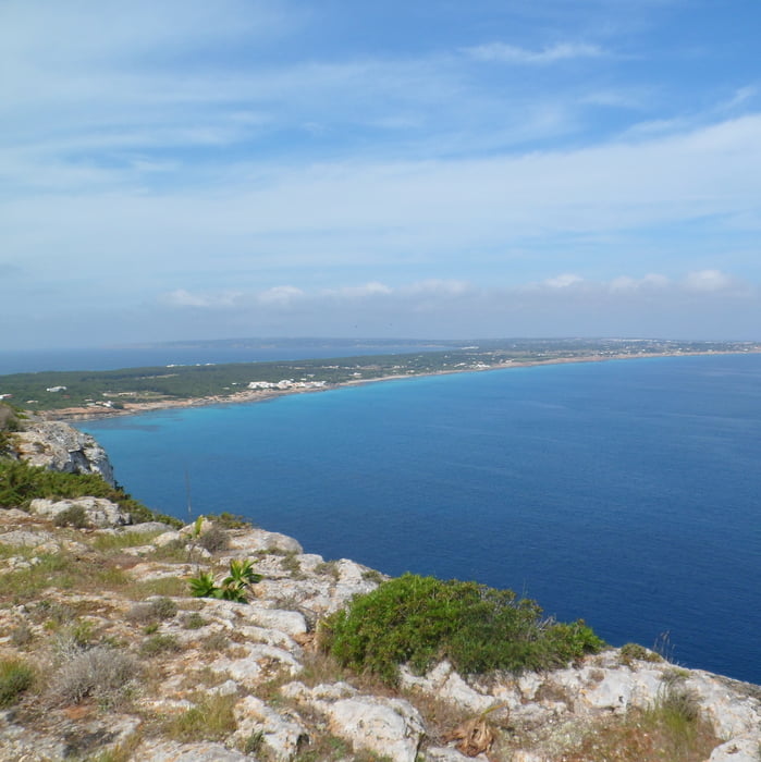
zunächst geht es auf dem alten restaurierten Pflasterweg Cami Roma aufwärts zur Hochebene La Mola, am Ende des Cami auf schmalen Pfaden , z.T. weglos zum Klippenrand, an diesem entlang, dann auf dem Cami de sa Cala zum Ort El Pilar und von dort den Cami d'es S'Estufador entlang zur Südküste hinab. Kurz hinter El Pilar ist links die restaurierte Windmühle Vell de la Mola zu sehen. An der Südküste geht es auf einem etwa 100 m parallel zur Küste verlaufenden Pfad entlang zur Calo del Ram, eine ins Land eingeschnittene Bucht. Oberhalb der Bucht beginnt eine Piste, die über den "Insel Highway" zurück zum Cami Roma führt.
galéria trás


Mapa trasy a výškový profil
Minimum height 1 m
Maximum height 154 m
More about the tour author
|
|
Lanzarottl |
komentáre

Hinter Es Calo nach der Linkskurve links ab Richtung Hostal Entre Pinos
GPS trasy
Trackpoints-
GPX / Garmin Map Source (gpx) download
-
TCX / Garmin Training Center® (tcx) download
-
CRS / Garmin Training Center® (crs) download
-
Google Earth (kml) download
-
G7ToWin (g7t) download
-
TTQV (trk) download
-
Overlay (ovl) download
-
Fugawi (txt) download
-
Kompass (DAV) Track (tk) download
-
list trasy (pdf) download
-
Original file of the author (gpx) download
More about the tour author
|
|
Lanzarottl |
Add to my favorites
Remove from my favorites
Edit tags
Open track
My score
Rate