Login

Zabudli ste prihlasovacia meno

Cookies have to be accepted!
Your browser's cookie functionality is disabled. Please enable this functionality.

Not a member yet?

Register now
Login

Available for registred users only

Log in to use this feature.

Zabudli ste prihlasovacia meno

Cookies have to be accepted!
Your browser's cookie functionality is disabled. Please enable this functionality.

Not a member yet?

Register now
Filter
Kategórie
Advanced filters
  • Dĺžka (km)
  • výškomer
Uložiť filter Reset filter

TrackRank

QRCode

Technical data

Dĺžka12,9 km výškomer319 m Way down324 m Doba00:00 h:m dátum06.07.2013
ohodnotenia Author Kraj pôžitok z túry kondícia technika

štatistika

897 náhľady ohodnotenia 13 Stiahnutia priemer
Rate
  • list trasy
  • príjazd
  • Stiahnutia

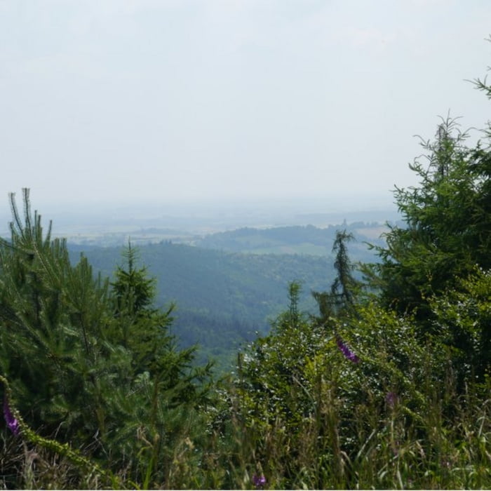
Die Tour führt um den Hohen Kopf durch den Mundartwald. Zunächst geht es gut ausgebauten Forstwirtschaftswegen entlang des Buchbachtals stetig bergauf bis hoch zur Burgruine Gutenberg, von der ein wunderschöner Ausblick möglich ist. Der Weg zurück zum Sankt Germanshof verläuft zunächst relativ eben bis zur Nähe des Buchbächels und führt dann auf einer kleinen asphaltierten Straße bergab zurück.


galéria trás

Mapa trasy a výškový profil

  • Open Street Map
  • Google
Minimum height 174 m Maximum height 510 m Detailný pohľad

More about the tour author

isg13
Member since 2010

Send private message

komentáre

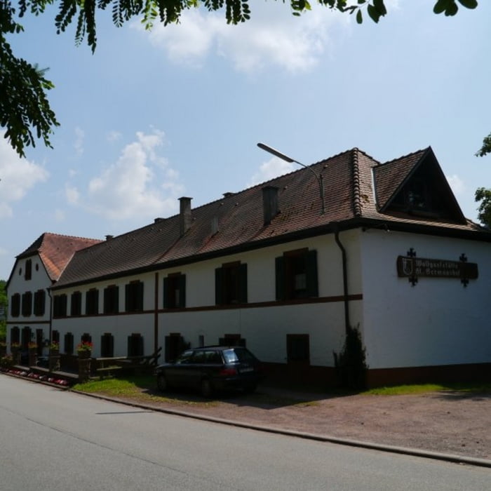
Startpunkt der Tour ist der Parkplatz direkt beim Sankt Germanshof.


GPS trasy

Trackpoints
  • GPX / Garmin Map Source (gpx) download
  • TCX / Garmin Training Center® (tcx) download
  • CRS / Garmin Training Center® (crs) download
  • Google Earth (kml) download
  • G7ToWin (g7t) download
  • TTQV (trk) download
  • Overlay (ovl) download
  • Fugawi (txt) download
  • Kompass (DAV) Track (tk) download
  • list trasy (pdf) download
  • Original file of the author (gpx) download

More about the tour author

isg13
Member since 2010

Send private message
Share track
Add to my favorites
Remove from my favorites
Edit tags
My score
Rate
trasa: Pfälzer Rundwanderung mit Einkehr - Sankt Germanshof
Druh: trasa
Dĺžka: 12,9 km
Evaluated on:
Doba:
Day(s)
Hour(s)
Minute(s)
ohodnotenie: Kraj pôžitok z túry kondícia technika