


Start und Ziel: Außervillgraten (1287m)
Wem dies nicht genug Höhenmeter sind - je Kondition, Lust, Laune, Zeit, etc. . . kann die Tour auch verlängert werden - z.B. von Heinfels (Lienz) aus bis zur Volkzeiner Hütte . . :-)
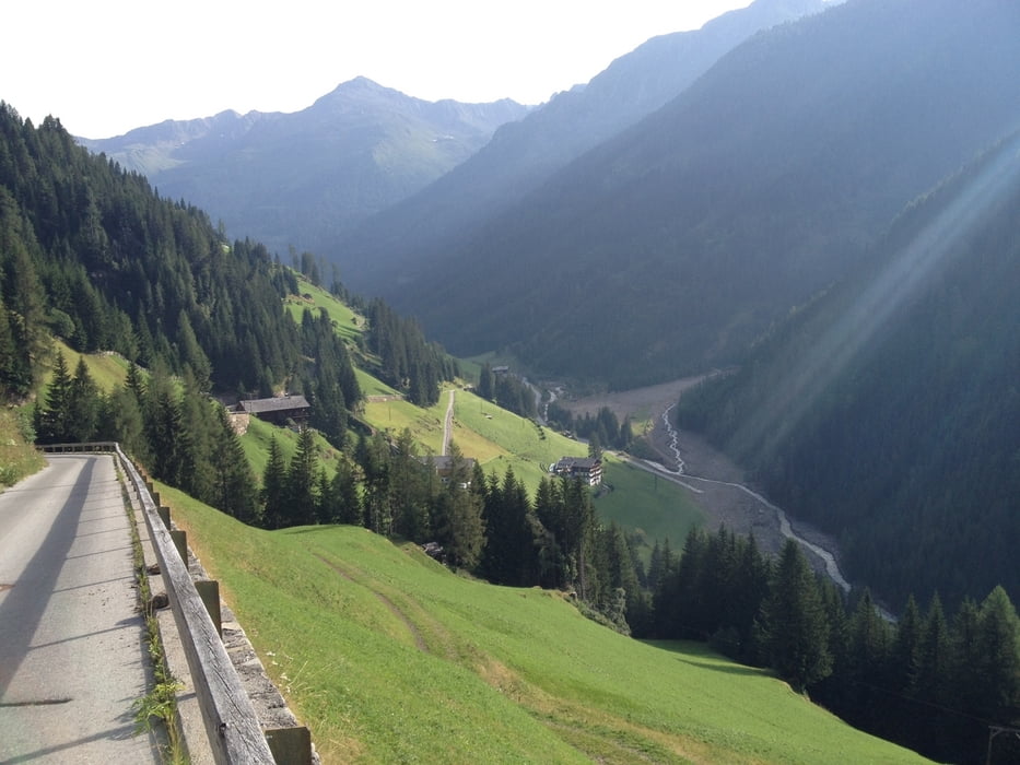
Wir fahren als Variante über Obwurzen (oberhalb des Winkeltals) bis zum Gasthaus Reiterstubn (1517m). Auf dieser schmalen, asphaltierten Strecke geht es gleich zur Sache - sprich es geht gleich steil berg auf!
Ab der Reithersube Schotterstraße. An diesem Tag war die Hauptstraße wegen Vermurungen gesperrt. Auch im Winkeltal mussten wir gleich zu Beginn der Schotterstrecke eine "Ausweichroute" wählen da auch hier die Straße weggespült wurde !
Bis zur Volkzeinerhütte (ehem. Sillianer Hütte 1884m) immer wieder nette Almen entlang dem Winkeltal.
Retour fahren wir unten im Tal entlang dem Winkeltalbach bis Außervillgraten.
Wem dies nicht genug Höhenmeter sind - je Kondition, Lust, Laune, Zeit, etc. . . kann die Tour auch verlängert werden - z.B. von Heinfels (Lienz) aus bis zur Volkzeiner Hütte . . :-)
Wir fahren als Variante über Obwurzen (oberhalb des Winkeltals) bis zum Gasthaus Reiterstubn (1517m). Auf dieser schmalen, asphaltierten Strecke geht es gleich zur Sache - sprich es geht gleich steil berg auf!
Ab der Reithersube Schotterstraße. An diesem Tag war die Hauptstraße wegen Vermurungen gesperrt. Auch im Winkeltal mussten wir gleich zu Beginn der Schotterstrecke eine "Ausweichroute" wählen da auch hier die Straße weggespült wurde !
Bis zur Volkzeinerhütte (ehem. Sillianer Hütte 1884m) immer wieder nette Almen entlang dem Winkeltal.
Retour fahren wir unten im Tal entlang dem Winkeltalbach bis Außervillgraten.
galéria trás


Mapa trasy a výškový profil
Minimum height 1240 m
Maximum height 1871 m
More about the tour author
|
|
chrissi9900 |
komentáre

GPS trasy
Trackpoints-
GPX / Garmin Map Source (gpx) download
-
TCX / Garmin Training Center® (tcx) download
-
CRS / Garmin Training Center® (crs) download
-
Google Earth (kml) download
-
G7ToWin (g7t) download
-
TTQV (trk) download
-
Overlay (ovl) download
-
Fugawi (txt) download
-
Kompass (DAV) Track (tk) download
-
list trasy (pdf) download
-
Original file of the author (gpx) download
More about the tour author
|
|
chrissi9900 |
Add to my favorites
Remove from my favorites
Edit tags
Open track
My score
Rate