


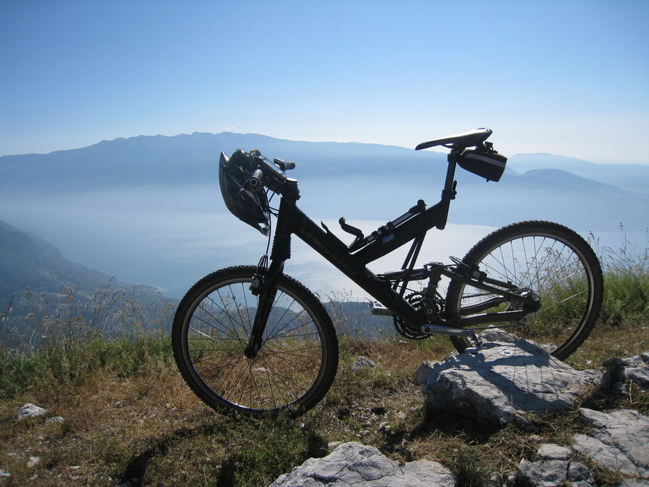
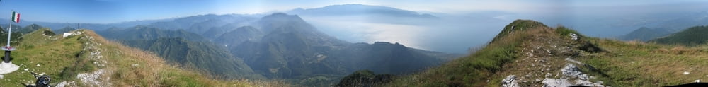
Hatte eine ähnliche Tour hier von der GPS-Tour.info Seite geladen und bereits gelesen, dass viele Schiebepassagen dabei sein sollen. Natuerlich ist mein Bike auch nicht mehr auf dem neusten Stand und meine aktuelle Kondition auch nicht top, aber ich behaupte, dass man das Ding wirklich nicht komplett fahren kann. Bitte gebt mir ein Feedback falls es doch jemand geschafft haben sollte. Ich war auch drauf und dran die Tour abzubrechen.....bei 36 Grad Temperatur auch verstaendlich (weswegen ich morgens um 6 Uhr losgerollt war), doch der Ausblick vom Gipfel entschaedigte!!!
Bei der Abfahrt solltet ihr nach der Haelfte in Richtung Maderno auf der breiteren Piste bleiben, ansonsten duerft ihr erneut schieben, falls ihr nicht zufaellig mit 'nem Downhill'er unterwegs seid?!
Die letzten Kilometer vor Salo verlaufen zwar auf Asphalt, der Ausblick ist aber super. Am Ende war der Akku meines Mobiles leer, daher fehlen die finalen Kilometer.
Viel Spass beim Biken!
galéria trás


Mapa trasy a výškový profil
Minimum height 106 m
Maximum height 1643 m
More about the tour author

|
quik-mic |
komentáre

Gardasee and GO!
GPS trasy
Trackpoints-
GPX / Garmin Map Source (gpx) download
-
TCX / Garmin Training Center® (tcx) download
-
CRS / Garmin Training Center® (crs) download
-
Google Earth (kml) download
-
G7ToWin (g7t) download
-
TTQV (trk) download
-
Overlay (ovl) download
-
Fugawi (txt) download
-
Kompass (DAV) Track (tk) download
-
list trasy (pdf) download
-
Original file of the author (gpx) download
More about the tour author
|
|
quik-mic |
Add to my favorites
Remove from my favorites
Edit tags
Open track
My score
Rate