


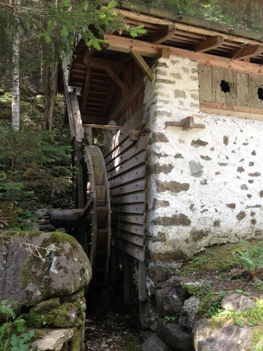
Von Tisens wandert man auf dem Mühlenweg in Richtung Bad Gfrill. Bevor man dieses erreicht steigt man nach einer Brücke rechts nach Gfrill hoch. Alternativ kann man auch den Umweg über Gfirll Bad machen. Von Gfrill geht es steil bergauf nach Platzers. Dort empfiehlt sich eine Einkehr im Berggasthof Natz. Danach geht es über Völlaner Badl nach Tisens zurück.
galéria trás

Mapa trasy a výškový profil
Minimum height 640 m
Maximum height 1291 m
More about the tour author

|
thmayr |
komentáre

Vom Meran über Lana nach Tisens
Von Bozen auf der Schnellstraße Richtung Meran, dann über Nals nach Tisens
GPS trasy
Trackpoints-
GPX / Garmin Map Source (gpx) download
-
TCX / Garmin Training Center® (tcx) download
-
CRS / Garmin Training Center® (crs) download
-
Google Earth (kml) download
-
G7ToWin (g7t) download
-
TTQV (trk) download
-
Overlay (ovl) download
-
Fugawi (txt) download
-
Kompass (DAV) Track (tk) download
-
list trasy (pdf) download
-
Original file of the author (gpx) download
More about the tour author
|
|
thmayr |
Add to my favorites
Remove from my favorites
Edit tags
Open track
My score
Rate