
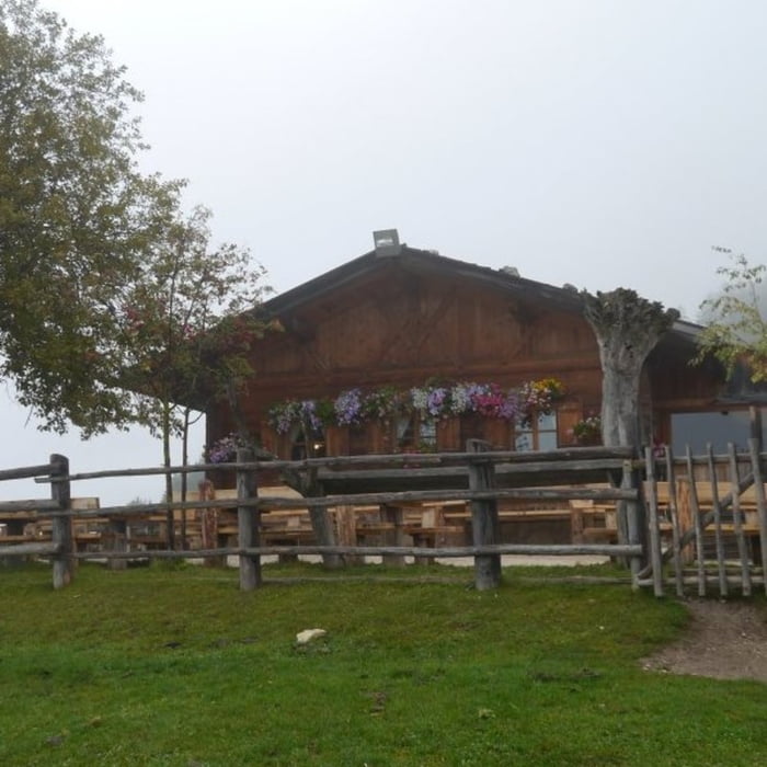

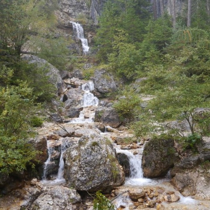
Die Tour startet von einem Parkplatz in der Nähe des Völser Weihers und verläuft zunächst auf gut ausgebauten Forstwirtschaftswegen. In der Nähe von Ums steigt ein schöner Pfad sehr steil an bis hoch zur Hofer Alpl – immer wieder sind schöne Ausblicke ins Rio Scilar-Tal möglich. Von der Hofer Alpl führt ein gut ausgebauter Weg leicht abfallend bis zum Völser Bach, der bei feuchtem Wetter in schönen kleinen Wasserfällen herunter fließt. Von dort geht ein schöner Pfad zur Tuffalm Hütte, die auf einem kleinen Plateau liegt und von der ein sehr schöner Blick auf die gegenüberliegenden Berge möglich ist. Die Strecke zurück zum Parkplatz verläuft bergab auf einem sehr gut ausgebauten Wirtschaftsweg.
galéria trás


Mapa trasy a výškový profil
Minimum height 956 m
Maximum height 1350 m
More about the tour author

|
isg13 |
komentáre

GPS trasy
Trackpoints-
GPX / Garmin Map Source (gpx) download
-
TCX / Garmin Training Center® (tcx) download
-
CRS / Garmin Training Center® (crs) download
-
Google Earth (kml) download
-
G7ToWin (g7t) download
-
TTQV (trk) download
-
Overlay (ovl) download
-
Fugawi (txt) download
-
Kompass (DAV) Track (tk) download
-
list trasy (pdf) download
-
Original file of the author (gpx) download
More about the tour author
|
|
isg13 |
Add to my favorites
Remove from my favorites
Edit tags
Open track
My score
Rate