
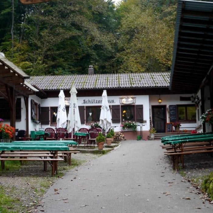

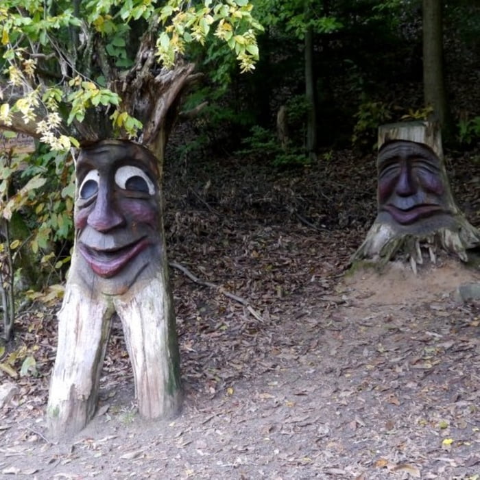
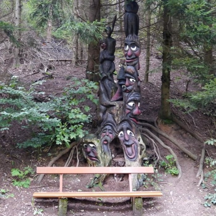
Start und Ziel der Tour ist das Schützenhaus in Otterbach. Die Strecke führt im Otterbachtal vom Schützenhaus hoch zur Otterbachquelle. Im unteren Teil verläuft die Tour entlang des von Volker Dahl geschaffenen Waldgeisterwegs, unzählige Figuren und Tiere hat er sehr schön in Baumstümpfe geschnitzt und bemalt. Von der Otterbachquelle geht es noch ein kleines Stück bergauf bis der höchste Punkt der Tour erreicht ist, anschließend fällt der Weg kontinuierlich ab. Die Infotafeln bei den Schutzhütten sowie verschiedene Bunker erzählen ein wenig aus der Geschichte der Weltkriege. Zurück zum Schützenhaus führt ein schöner kleiner Pfad der sehr angenehm durch Nadeln und Laub gepolstert ist.
galéria trás


Mapa trasy a výškový profil
Minimum height 209 m
Maximum height 447 m
More about the tour author

|
isg13 |
komentáre

GPS trasy
Trackpoints-
GPX / Garmin Map Source (gpx) download
-
TCX / Garmin Training Center® (tcx) download
-
CRS / Garmin Training Center® (crs) download
-
Google Earth (kml) download
-
G7ToWin (g7t) download
-
TTQV (trk) download
-
Overlay (ovl) download
-
Fugawi (txt) download
-
Kompass (DAV) Track (tk) download
-
list trasy (pdf) download
-
Original file of the author (gpx) download
More about the tour author
|
|
isg13 |
Add to my favorites
Remove from my favorites
Edit tags
Open track
My score
Rate