


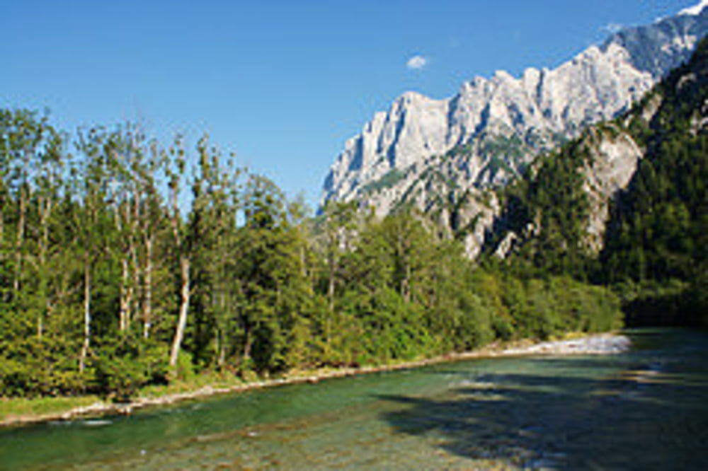
Der Große Buchstein 2.224m erhebt sich nördlich der Enns beim Gesäuseeingang und ist Teil vom Nationalpark Gesäuse. Er hat einen kastellartigen Gipfelaufbau mit allseits schroff abfallenden Felswänden aus Dachsteinkalk und ein ausgedehntes, muldenartiges Karstplateau. Vom Gipfel und vom Buchsteinhaus hat man eine hervorragende Aussicht auf die nördlichen Wände der Hochtor- und Reichsteingruppe. Dies sind besonders gute Plätze um das Alpenglühen am späten Nachmittag bzw. frühen Abend zu erleben, wenn die untergehende Sonne die Kalkwände in ein goldrotes Licht tauchen. Wegen der gestuften Passagen (UIAA I), Geröll und Seilversicherungen, sind Trittsicherheit und Schwindelfreiheit ab dem Buchsteinhaus auch auf dem Normalweg unbedingt erforderlich!
weitere Infos und Bilder findest du auf biketours4you.at
galéria trás


Mapa trasy a výškový profil
Minimum height 573 m
Maximum height 2182 m
More about the tour author
|
|
Trek1400d |
komentáre

Parkmöglichkeiten gibt es von Admont kommend kurz vor der Ennsbrücke, oder in Gstatterboden beim Naturpark Pavillon.
GPS trasy
Trackpoints-
GPX / Garmin Map Source (gpx) download
-
TCX / Garmin Training Center® (tcx) download
-
CRS / Garmin Training Center® (crs) download
-
Google Earth (kml) download
-
G7ToWin (g7t) download
-
TTQV (trk) download
-
Overlay (ovl) download
-
Fugawi (txt) download
-
Kompass (DAV) Track (tk) download
-
list trasy (pdf) download
-
Original file of the author (gpx) download
More about the tour author
|
|
Trek1400d |
Add to my favorites
Remove from my favorites
Edit tags
Open track
My score
Rate