

Schöne, kurze Tour.
Teerstraße hoch, Trails auf der Ebene, schöner Trail hinab.
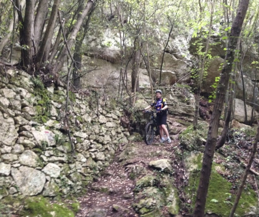
In der Waldpassage muss man ab und zu mal absteigen, sonst alles gut fahrbar.
Further information at
http://randypanguitch.wordpress.com/randy-panguitch-startseite/mtb-touren/tagestouren/tagestouren_italien/tt_i_ligurien_hinterland_finale/Mapa trasy a výškový profil
Minimum height -13 m
Maximum height 323 m
More about the tour author
|
|
RandB |
komentáre
GPS trasy
Trackpoints-
GPX / Garmin Map Source (gpx) download
-
TCX / Garmin Training Center® (tcx) download
-
CRS / Garmin Training Center® (crs) download
-
Google Earth (kml) download
-
G7ToWin (g7t) download
-
TTQV (trk) download
-
Overlay (ovl) download
-
Fugawi (txt) download
-
Kompass (DAV) Track (tk) download
-
list trasy (pdf) download
-
Original file of the author (gpx) download
More about the tour author
|
|
RandB |
Add to my favorites
Remove from my favorites
Edit tags
Open track
My score
Rate
Neu Rughetta
Macht aber nix, es wurde eine neue Route geschaffen. Gleiche Anfahrt, nur das "Mittelstück" ist neu. Etwas techhnischer, aber (wenn man die alte Terassenstrasse nicht kennt) auch superschön. Der Teil durch den Märchenwald vorbei an den Höhlenunterkünften alleine ist diese Tour wert!