Login

Zabudli ste prihlasovacia meno

Cookies have to be accepted!
Your browser's cookie functionality is disabled. Please enable this functionality.

Not a member yet?

Register now
Login

Available for registred users only

Log in to use this feature.

Zabudli ste prihlasovacia meno

Cookies have to be accepted!
Your browser's cookie functionality is disabled. Please enable this functionality.

Not a member yet?

Register now
Filter
Kategórie
Advanced filters
  • Dĺžka (km)
  • výškomer
Uložiť filter Reset filter

TrackRank

QRCode

Technical data

Dĺžka11,5 km výškomer505 m Way down496 m Doba03:30 h:m dátum10.06.2014
ohodnotenia Author Kraj pôžitok z túry kondícia technika

štatistika

2004 náhľady ohodnotenia 108 Stiahnutia priemer
Rate
  • list trasy
  • príjazd
  • Stiahnutia
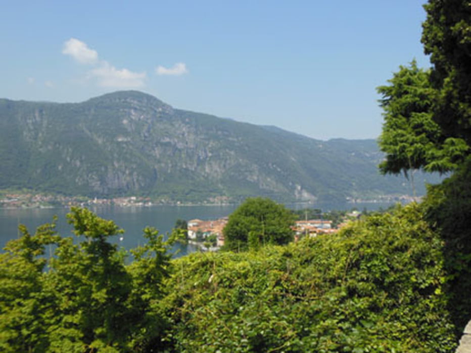
Parte dell'antico sentiero che veniva usato per il collegamento dalla pianura padana con la valtellina e la Svizzera. Molto facile da percorrere ed estremamente panoramico, dove da un lato vedi il lago e dall'altro le montagne.

galéria trás

Mapa trasy a výškový profil

  • Open Street Map
  • Google
Minimum height 252 m Maximum height 492 m Detailný pohľad

More about the tour author

MicheleCruciani
Member since 2014

Send private message

komentáre

GPS trasy

Trackpoints
  • GPX / Garmin Map Source (gpx) download
  • TCX / Garmin Training Center® (tcx) download
  • CRS / Garmin Training Center® (crs) download
  • Google Earth (kml) download
  • G7ToWin (g7t) download
  • TTQV (trk) download
  • Overlay (ovl) download
  • Fugawi (txt) download
  • Kompass (DAV) Track (tk) download
  • list trasy (pdf) download
  • Original file of the author (gpx) download

More about the tour author

MicheleCruciani
Member since 2014

Send private message
Share track
Add to my favorites
Remove from my favorites
Edit tags
My score
Rate
trasa: Sentiero del viandante da Abbadia Lariana a Lierna
Druh: horská trasa
Dĺžka: 11,5 km
Evaluated on:
Doba:
Day(s)
Hour(s)
Minute(s)
ohodnotenie: Kraj pôžitok z túry kondícia technika