


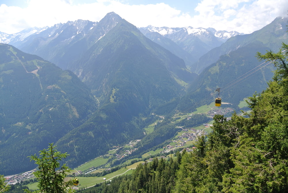
Zunächst mit der Seilbahn auf den Penken. Ganz oben angekommen weitergeradelt bis Christas Skialm. Danach gehts ewig bergab.
Leider haben wir uns dann ein bisschen verfranzt und sind den Wanderweg (30 cm Breit, unheimlich Steil, tausende Wurzeln und Steine) im zickzack den Berg hinunter.
Also gibt diese Tour neben einer wundervollen Radtour auch noch eine sehr schöne Wanderroute ab. ABER: Räder den Berg runterschieben kostet ca. 3 Kilo und 8 Liter Schweiss.......
galéria trás

Mapa trasy a výškový profil
Minimum height 406 m
Maximum height 2101 m
More about the tour author

|
reigeissinger |
komentáre

GPS trasy
Trackpoints-
GPX / Garmin Map Source (gpx) download
-
TCX / Garmin Training Center® (tcx) download
-
CRS / Garmin Training Center® (crs) download
-
Google Earth (kml) download
-
G7ToWin (g7t) download
-
TTQV (trk) download
-
Overlay (ovl) download
-
Fugawi (txt) download
-
Kompass (DAV) Track (tk) download
-
list trasy (pdf) download
-
Original file of the author (gpx) download
More about the tour author
|
|
reigeissinger |
Add to my favorites
Remove from my favorites
Edit tags
Open track
My score
Rate