Login

Zabudli ste prihlasovacia meno

Cookies have to be accepted!
Your browser's cookie functionality is disabled. Please enable this functionality.

Not a member yet?

Register now
Login

Available for registred users only

Log in to use this feature.

Zabudli ste prihlasovacia meno

Cookies have to be accepted!
Your browser's cookie functionality is disabled. Please enable this functionality.

Not a member yet?

Register now
Filter
Kategórie
Advanced filters
  • Dĺžka (km)
  • výškomer
Uložiť filter Reset filter

TrackRank

QRCode

Technical data

Dĺžka20,6 km výškomer1017 m Way down1011 m Doba08:00 h:m dátum22.07.2014
ohodnotenia Author Kraj pôžitok z túry kondícia technika

štatistika

643 náhľady ohodnotenia 13 Stiahnutia priemer
Rate
  • list trasy
  • príjazd
  • Stiahnutia

Nesslau - Bläss-Chopf - Schilt - Bütz - Hengst - Nesslau

Eine Runde durchs höchste Nagelfluhgebirge in Europa. Es besteht dir Möglichkeit für einen Abstecher auf den Speer (+2h)

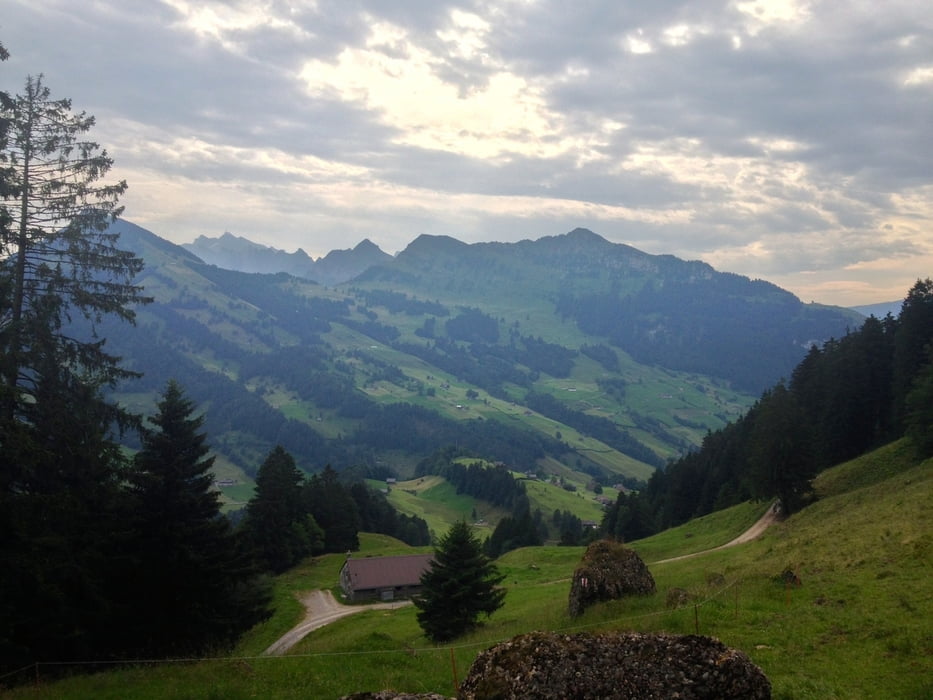
Man sieht das Säntismassiv, Churfirsten und etwa 100 weitere Gipfel. Sehr eindrucksvoll.
 

Auf dem Rückweg gibt es verschiedene Beizen, die zur Rast einladen.

galéria trás

Mapa trasy a výškový profil

  • Open Street Map
  • Google
Minimum height 769 m Maximum height 1669 m Detailný pohľad

More about the tour author

goldohulk
Member since 2014

Send private message

komentáre

Parken in Nesslau am Bahnhof. Dort gibt es auch kostenfreie Parkplätze.

GPS trasy

Trackpoints
  • GPX / Garmin Map Source (gpx) download
  • TCX / Garmin Training Center® (tcx) download
  • CRS / Garmin Training Center® (crs) download
  • Google Earth (kml) download
  • G7ToWin (g7t) download
  • TTQV (trk) download
  • Overlay (ovl) download
  • Fugawi (txt) download
  • Kompass (DAV) Track (tk) download
  • list trasy (pdf) download
  • Original file of the author (gpx) download

More about the tour author

goldohulk
Member since 2014

Send private message
Share track
Add to my favorites
Remove from my favorites
Edit tags
My score
Rate
trasa: Nesslau-Blässchopf-Nesslau
Druh: horská trasa
Dĺžka: 20,6 km
Evaluated on:
Doba:
Day(s)
Hour(s)
Minute(s)
ohodnotenie: Kraj pôžitok z túry kondícia technika