


S2
Hinterthal-Filzensattel-Lend-Jagahäusl-Walchalm-Wetterkreuz-
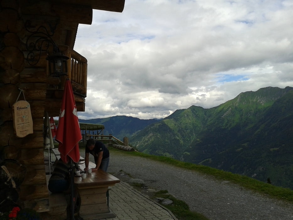
Biberalm-Bad Hofgastein-Bad Gastein
(Hochkönig,Gasteinertal/ZE,JO)
Sehr schöne, abwechslungsreiche Tour, endlich wieder in einer Hütte eingekehrt.
Herrlicher Übergang beim Wetterkreuz. Abfahrt zur Biberalm nur für Experten möglich (S2). Nach Bad Gastein hinauf noch mal überraschend steil.
Wieder tolles Wetter! Gutes und preiswertes Quartier direkt beim Bahnhof bzw. Therme.
Youth Hotel Krone: NF 27€ - gut.S2
Hinterthal-Filzensattel-Lend-Jagahäusl-Walchalm-Wetterkreuz-
Biberalm-Bad Hofgastein-Bad Gastein
(Hochkönig,Gasteinertal/ZE,JO)
Sehr schöne, abwechslungsreiche Tour, endlich wieder in einer Hütte eingekehrt.
Herrlicher Übergang beim Wetterkreuz. Abfahrt zur Biberalm nur für Experten möglich (S2). Nach Bad Gastein hinauf noch mal überraschend steil.
Wieder tolles Wetter! Gutes und preiswertes Quartier direkt beim Bahnhof bzw. Therme.
Youth Hotel Krone: NF 27€ - gut.
galéria trás

Mapa trasy a výškový profil
Minimum height 648 m
Maximum height 1925 m
More about the tour author
|
|
mitter |
komentáre

Start in Hinterthal Pension Fersterer.
GPS trasy
Trackpoints-
GPX / Garmin Map Source (gpx) download
-
TCX / Garmin Training Center® (tcx) download
-
CRS / Garmin Training Center® (crs) download
-
Google Earth (kml) download
-
G7ToWin (g7t) download
-
TTQV (trk) download
-
Overlay (ovl) download
-
Fugawi (txt) download
-
Kompass (DAV) Track (tk) download
-
list trasy (pdf) download
-
Original file of the author (gpx) download
More about the tour author
|
|
mitter |
Add to my favorites
Remove from my favorites
Edit tags
Open track
My score
Rate