


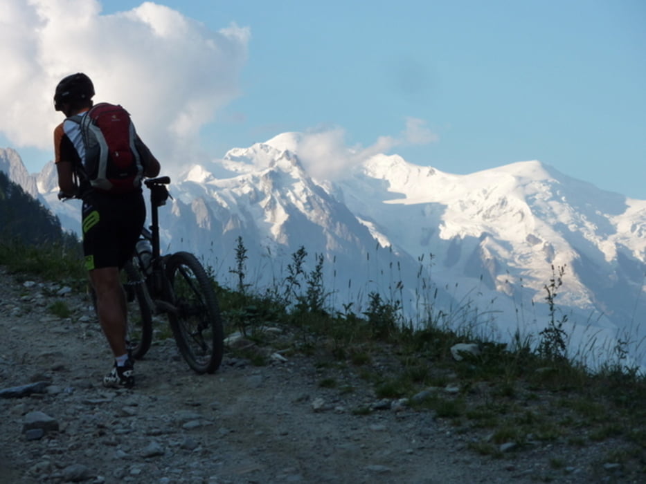
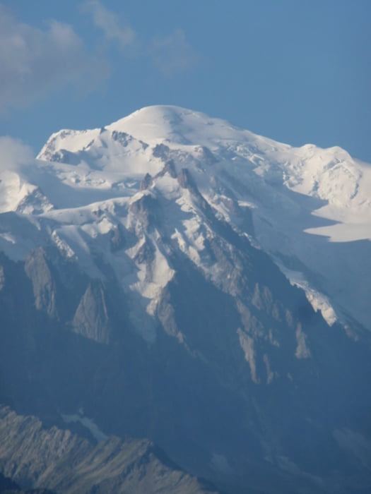
Die Auffahrt zum Col de Balme ist schön steil und läßt einen gleich ordentlich schwitzen. Der Rückblick auf den Mont Blanc ist unbeschreiblich! Oben angelangt geht es nun über die Grenze und auf wunderschönen Singletrail in Richtung Col de la Forclaz. Auch hier ist wieder vorausschauendes Fahren angesagt und eine objektive Einschätzung der eigenen Fähigkeiten.
Vom Col de la Forclaz hinunter (auf des Abfahrt die Abzweigung nach le Fays nicht verpassen) gehts nach Martigny-Combe und weiter nach les Valettes. Von dort beginnt die gnadenlose Steigung zurück nach Champex. Diese muß man sich leider mit Motorrädern und Autos teilen.
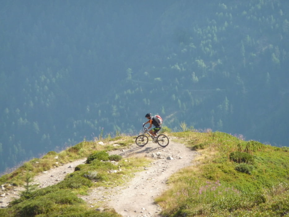
Wer darauf verzichten möchte, zweigt den Wanderweg (TMB) am Col de la Forclaz (am Paßschild) in Richtung Portalo (auf 2049 m.ü.M.) ab und nimmt eine länger Schiebestrecke auf sich. Von dort geht ein Trail nach Bovine (1987 m.ü.M.). Nach la Jure (1666 m.ü.M.) gehts tragender Weise weiter. Von dort dann wieder Trail und Schotterweg über den Plan de l Au nach Champex.
galéria trás

Mapa trasy a výškový profil
Minimum height 520 m
Maximum height 2073 m
More about the tour author
|
|
CF2008 |
komentáre

GPS trasy
Trackpoints-
GPX / Garmin Map Source (gpx) download
-
TCX / Garmin Training Center® (tcx) download
-
CRS / Garmin Training Center® (crs) download
-
Google Earth (kml) download
-
G7ToWin (g7t) download
-
TTQV (trk) download
-
Overlay (ovl) download
-
Fugawi (txt) download
-
Kompass (DAV) Track (tk) download
-
list trasy (pdf) download
-
Original file of the author (gpx) download
More about the tour author
|
|
CF2008 |
Add to my favorites
Remove from my favorites
Edit tags
Open track
My score
Rate