


Das Hohe Venn ist ein Naturschutzgebiet im deutsch/belgischen Grenzgebiet.
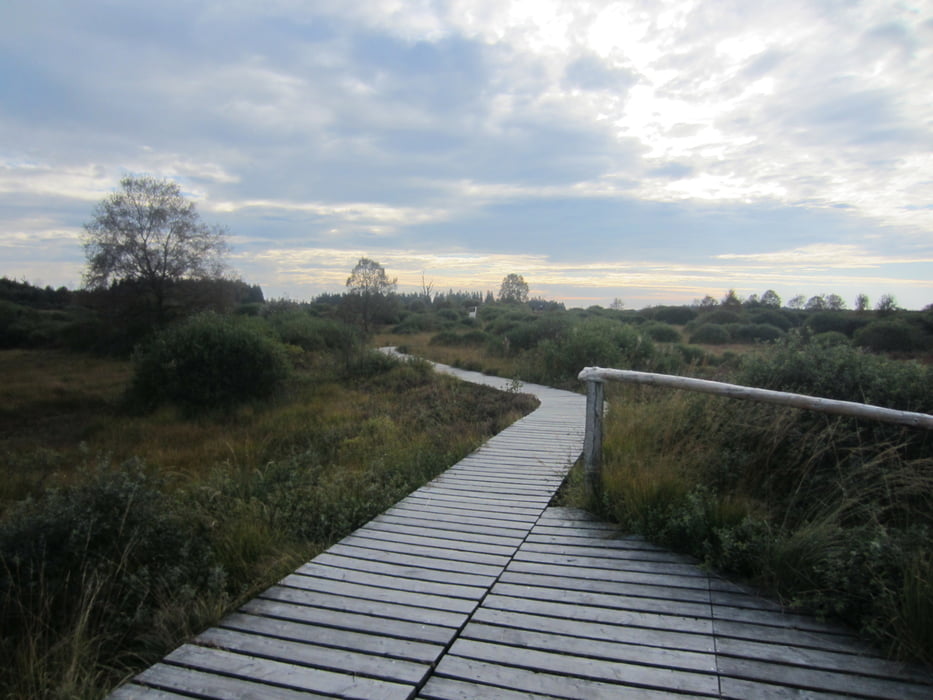
Die Landschaft ist geprägt durch große Hochmoorflächen, die zum großen Teil über Holzstege bzw. schmale Pfade durchquert werden. Vorbei geht es entlang großer Waldstücke und wunderschönen Flächen mit Heidepflanzen wie z.B. Besen- und Glockeheide.
Festes Schuhwerk ist ein Muss, denn die Stege sind manchmal etwas morsch und die Pfade schlammig.
Bei besonderen Gefahren wird eine rote oder rot-weiße Fahne gehisst (Brandgefahr, eingeschneite Wege). Der Durchgang dieser Bereiche ist dann untersagt.
Unterwegs kommt man immer wieder an Tafeln vorbei, welche die Entstehung des Hochmoores erklären, so wie Infos zu Fauna und Flora geben.
galéria trás


Mapa trasy a výškový profil
Minimum height 515 m
Maximum height 622 m
More about the tour author
|
|
Wandersocken |
komentáre

Parkplatz Nahtsief, Monschauer Str. (N67), GPS-Daten vom Parkplatz Nahtsief: 50.567838, 6.180428
Der Parkplatz liegt von Monschau-Mützenich ca 1 km entfernt kurz der hinter belgischen Grenze
GPS trasy
Trackpoints-
GPX / Garmin Map Source (gpx) download
-
TCX / Garmin Training Center® (tcx) download
-
CRS / Garmin Training Center® (crs) download
-
Google Earth (kml) download
-
G7ToWin (g7t) download
-
TTQV (trk) download
-
Overlay (ovl) download
-
Fugawi (txt) download
-
Kompass (DAV) Track (tk) download
-
list trasy (pdf) download
-
Original file of the author (gpx) download
More about the tour author
|
|
Wandersocken |
Add to my favorites
Remove from my favorites
Edit tags
Open track
My score
Rate