Nun ist es wieder so weit, ich fahre seit Ende September mit Licht. Und an diesem Morgen fängt es auch noch zu regnen an.
Ich fahre also zu meinem Tagwerk und merke im Taubental azf halber Strecke dass ich einen Platten bekomme. Das ist toll: Bei Dunkelheit mit der Stirnlampe den Platten flicken. Und dann ließ ich auch noch ein kleines Teil liegen...
Also fuhr ich am Abend wieder in das Taubental um das liegen gebliebene Teil wieder einzusammeln. Wenn ich es wieder finden sollte wollte ich noch ein paar Höhenmeter drauflegen.
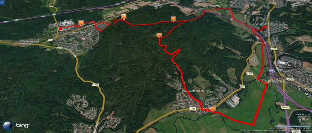
Ich fand mein verloren gegangenes Reperaturset und fuhr deshalb noch über die 7 Fichten nach Bierbach hinunter und belohnte mich mit dieser landschaftlich schönen Variante auf meinem Rückweg.
Further information at
https://de.wikipedia.org/wiki/Biosph%C3%A4renreservat_Bliesgaugaléria trás
Mapa trasy a výškový profil
Minimum height 226 m
Maximum height 345 m
komentáre

Start und Ziel in Homburg Schwarzenbach.
GPS trasy
Trackpoints-
GPX / Garmin Map Source (gpx) download
-
TCX / Garmin Training Center® (tcx) download
-
CRS / Garmin Training Center® (crs) download
-
Google Earth (kml) download
-
G7ToWin (g7t) download
-
TTQV (trk) download
-
Overlay (ovl) download
-
Fugawi (txt) download
-
Kompass (DAV) Track (tk) download
-
list trasy (pdf) download
-
Original file of the author (gpx) download
Add to my favorites
Remove from my favorites
Edit tags
Open track
My score
Rate

